You are here: Home > Network List > LD - Lamont-Doherty Cooperative Seismographic Network Stations List
> Station MVL Millersville University, PA > Earthquake Result Viewer
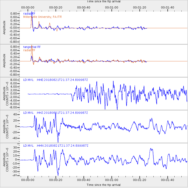
MVL Millersville University, PA - Earthquake Result Viewer
*The percent match for this event was below the threshold and hence no stack was calculated.
| Earthquake location: |
Near Coast Of Venezuela |
| Earthquake latitude/longitude: |
10.9/-62.9 |
| Earthquake time(UTC): |
2018/08/21 (233) 21:31:46 GMT |
| Earthquake Depth: |
154 km |
| Earthquake Magnitude: |
7.3 Mww |
| Earthquake Catalog/Contributor: |
NEIC PDE/us |
|
| Network: |
LD Lamont-Doherty Cooperative Seismographic Network |
| Station: |
MVL Millersville University, PA |
| Lat/Lon: |
40.00 N/76.35 W |
| Elevation: |
91 m |
|
| Distance: |
31.4 deg |
| Az: |
339.91 deg |
| Baz: |
153.943 deg |
| Ray Param: |
$rayparam |
*The percent match for this event was below the threshold and hence was not used in the summary stack. |
|
| Radial Match: |
94.103386 % |
| Radial Bump: |
308 |
| Transverse Match: |
85.74664 % |
| Transverse Bump: |
332 |
| SOD ConfigId: |
13570011 |
| Insert Time: |
2019-04-30 22:27:17.037 +0000 |
| GWidth: |
2.5 |
| Max Bumps: |
400 |
| Tol: |
0.001 |
|
Signal To Noise
| Channel | StoN | STA | LTA |
| LD:MVL: :HHZ:20180821T21:37:24.899987Z | 63.97838 | 9.7209595E-6 | 1.5194132E-7 |
| LD:MVL: :HHN:20180821T21:37:24.899987Z | 48.61647 | 6.061703E-6 | 1.2468415E-7 |
| LD:MVL: :HHE:20180821T21:37:24.899987Z | 9.92237 | 9.607008E-7 | 9.6821715E-8 |
| Arrivals |
| Ps | |
| PpPs | |
| PsPs/PpSs | |


