You are here: Home > Network List > TA - USArray Transportable Network (new EarthScope stations) Stations List
> Station R13A O'Grain Ranch, Modena, UT, USA > Earthquake Result Viewer
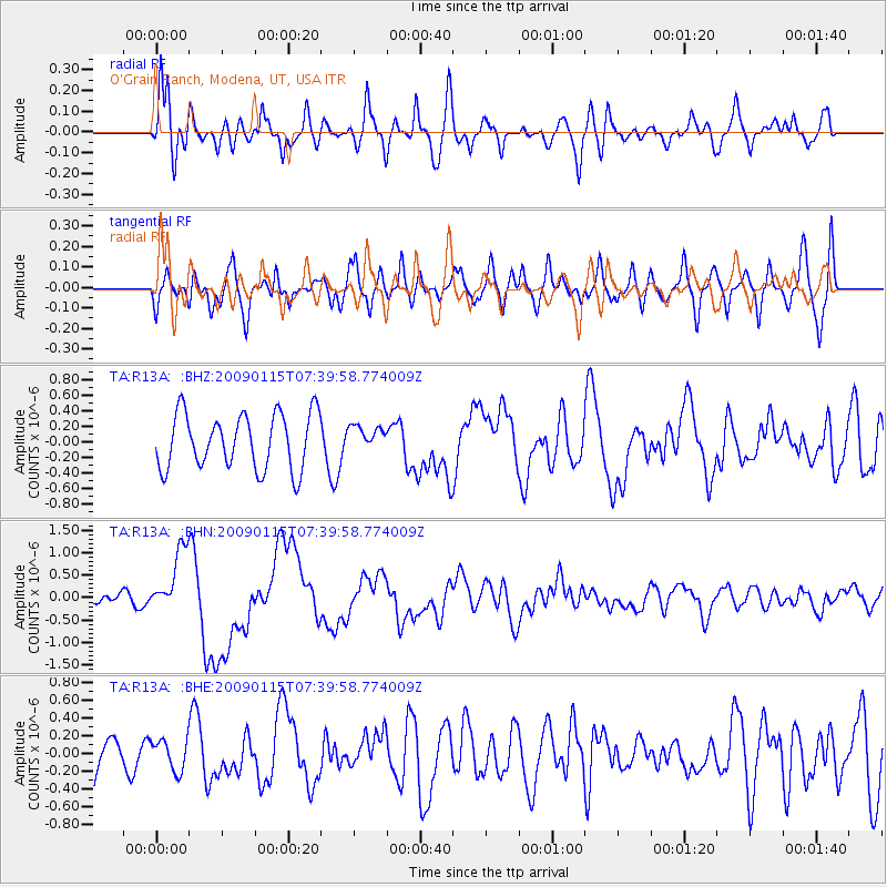
R13A O'Grain Ranch, Modena, UT, USA - Earthquake Result Viewer
*The percent match for this event was below the threshold and hence no stack was calculated.
| Earthquake location: |
Southeast Of Loyalty Islands |
| Earthquake latitude/longitude: |
-22.4/170.6 |
| Earthquake time(UTC): |
2009/01/15 (015) 07:27:20 GMT |
| Earthquake Depth: |
27 km |
| Earthquake Magnitude: |
5.8 MB, 6.5 MS, 6.7 MW, 6.6 MW |
| Earthquake Catalog/Contributor: |
WHDF/NEIC |
|
| Network: |
TA USArray Transportable Network (new EarthScope stations) |
| Station: |
R13A O'Grain Ranch, Modena, UT, USA |
| Lat/Lon: |
38.18 N/113.97 W |
| Elevation: |
1969 m |
|
| Distance: |
92.8 deg |
| Az: |
49.776 deg |
| Baz: |
243.756 deg |
| Ray Param: |
$rayparam |
*The percent match for this event was below the threshold and hence was not used in the summary stack. |
|
| Radial Match: |
60.706364 % |
| Radial Bump: |
400 |
| Transverse Match: |
48.599804 % |
| Transverse Bump: |
400 |
| SOD ConfigId: |
2834 |
| Insert Time: |
2010-03-06 14:30:59.157 +0000 |
| GWidth: |
2.5 |
| Max Bumps: |
400 |
| Tol: |
0.001 |
|
Signal To Noise
| Channel | StoN | STA | LTA |
| TA:R13A: :BHN:20090115T07:39:58.774009Z | 5.569506 | 7.212222E-7 | 1.2949482E-7 |
| TA:R13A: :BHE:20090115T07:39:58.774009Z | 0.498419 | 1.7646934E-7 | 3.5405824E-7 |
| TA:R13A: :BHZ:20090115T07:39:58.774009Z | 0.4432459 | 1.5627063E-7 | 3.5255968E-7 |
| Arrivals |
| Ps | |
| PpPs | |
| PsPs/PpSs | |


