You are here: Home > Network List > TA - USArray Transportable Network (new EarthScope stations) Stations List
> Station R13A O'Grain Ranch, Modena, UT, USA > Earthquake Result Viewer
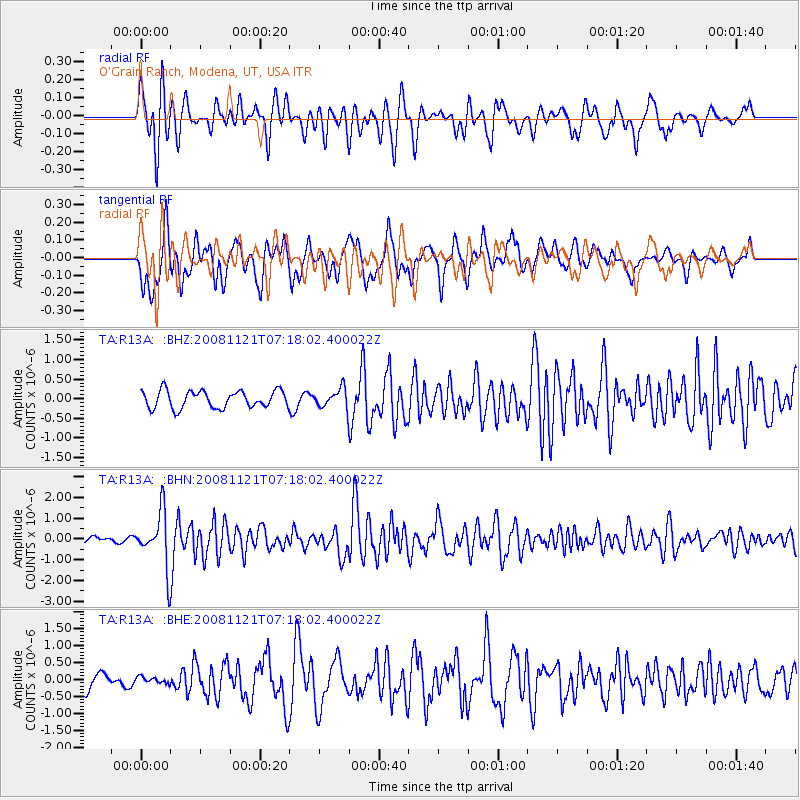
R13A O'Grain Ranch, Modena, UT, USA - Earthquake Result Viewer
*The percent match for this event was below the threshold and hence no stack was calculated.
| Earthquake location: |
Solomon Islands |
| Earthquake latitude/longitude: |
-8.9/159.6 |
| Earthquake time(UTC): |
2008/11/21 (326) 07:05:34 GMT |
| Earthquake Depth: |
118 km |
| Earthquake Magnitude: |
6.0 MB, 6.1 MW, 6.0 MW |
| Earthquake Catalog/Contributor: |
WHDF/NEIC |
|
| Network: |
TA USArray Transportable Network (new EarthScope stations) |
| Station: |
R13A O'Grain Ranch, Modena, UT, USA |
| Lat/Lon: |
38.18 N/113.97 W |
| Elevation: |
1969 m |
|
| Distance: |
92.7 deg |
| Az: |
51.95 deg |
| Baz: |
260.834 deg |
| Ray Param: |
$rayparam |
*The percent match for this event was below the threshold and hence was not used in the summary stack. |
|
| Radial Match: |
75.79372 % |
| Radial Bump: |
400 |
| Transverse Match: |
65.18265 % |
| Transverse Bump: |
400 |
| SOD ConfigId: |
2658 |
| Insert Time: |
2010-03-06 14:31:02.419 +0000 |
| GWidth: |
2.5 |
| Max Bumps: |
400 |
| Tol: |
0.001 |
|
Signal To Noise
| Channel | StoN | STA | LTA |
| TA:R13A: :BHN:20081121T07:18:02.400022Z | 7.5308843 | 1.3102747E-6 | 1.7398683E-7 |
| TA:R13A: :BHE:20081121T07:18:02.400022Z | 0.34381723 | 8.859935E-8 | 2.5769316E-7 |
| TA:R13A: :BHZ:20081121T07:18:02.400022Z | 1.137354 | 2.501097E-7 | 2.199049E-7 |
| Arrivals |
| Ps | |
| PpPs | |
| PsPs/PpSs | |


