You are here: Home > Network List > TA - USArray Transportable Network (new EarthScope stations) Stations List
> Station C16K Lisburne Hills, AK, USA > Earthquake Result Viewer
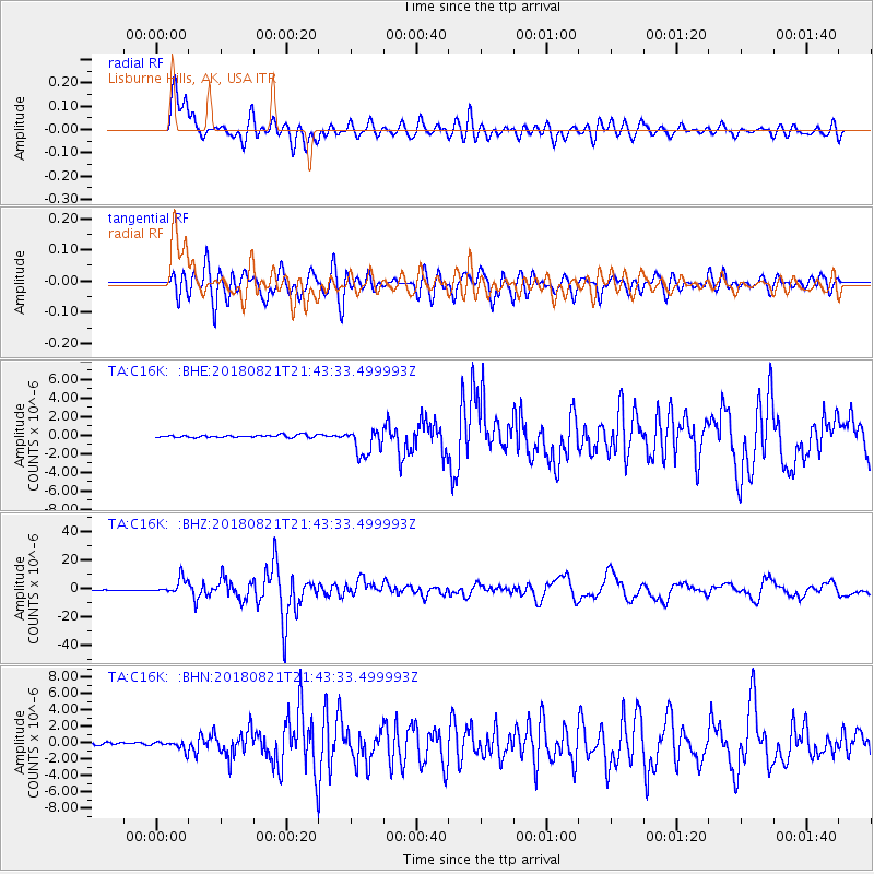
C16K Lisburne Hills, AK, USA - Earthquake Result Viewer
*The percent match for this event was below the threshold and hence no stack was calculated.
| Earthquake location: |
Near Coast Of Venezuela |
| Earthquake latitude/longitude: |
10.9/-62.9 |
| Earthquake time(UTC): |
2018/08/21 (233) 21:31:46 GMT |
| Earthquake Depth: |
154 km |
| Earthquake Magnitude: |
7.3 Mww |
| Earthquake Catalog/Contributor: |
NEIC PDE/us |
|
| Network: |
TA USArray Transportable Network (new EarthScope stations) |
| Station: |
C16K Lisburne Hills, AK, USA |
| Lat/Lon: |
68.27 N/165.34 W |
| Elevation: |
102 m |
|
| Distance: |
84.6 deg |
| Az: |
338.581 deg |
| Baz: |
74.479 deg |
| Ray Param: |
$rayparam |
*The percent match for this event was below the threshold and hence was not used in the summary stack. |
|
| Radial Match: |
92.74828 % |
| Radial Bump: |
400 |
| Transverse Match: |
89.81408 % |
| Transverse Bump: |
400 |
| SOD ConfigId: |
13570011 |
| Insert Time: |
2019-04-30 22:32:00.476 +0000 |
| GWidth: |
2.5 |
| Max Bumps: |
400 |
| Tol: |
0.001 |
|
Signal To Noise
| Channel | StoN | STA | LTA |
| TA:C16K: :BHZ:20180821T21:43:33.499993Z | 30.705881 | 5.261986E-6 | 1.7136738E-7 |
| TA:C16K: :BHN:20180821T21:43:33.499993Z | 3.930437 | 5.144677E-7 | 1.3089326E-7 |
| TA:C16K: :BHE:20180821T21:43:33.499993Z | 9.810401 | 1.1052489E-6 | 1.1266092E-7 |
| Arrivals |
| Ps | |
| PpPs | |
| PsPs/PpSs | |


