You are here: Home > Network List > TA - USArray Transportable Network (new EarthScope stations) Stations List
> Station E20K Nigu River, AK, USA > Earthquake Result Viewer
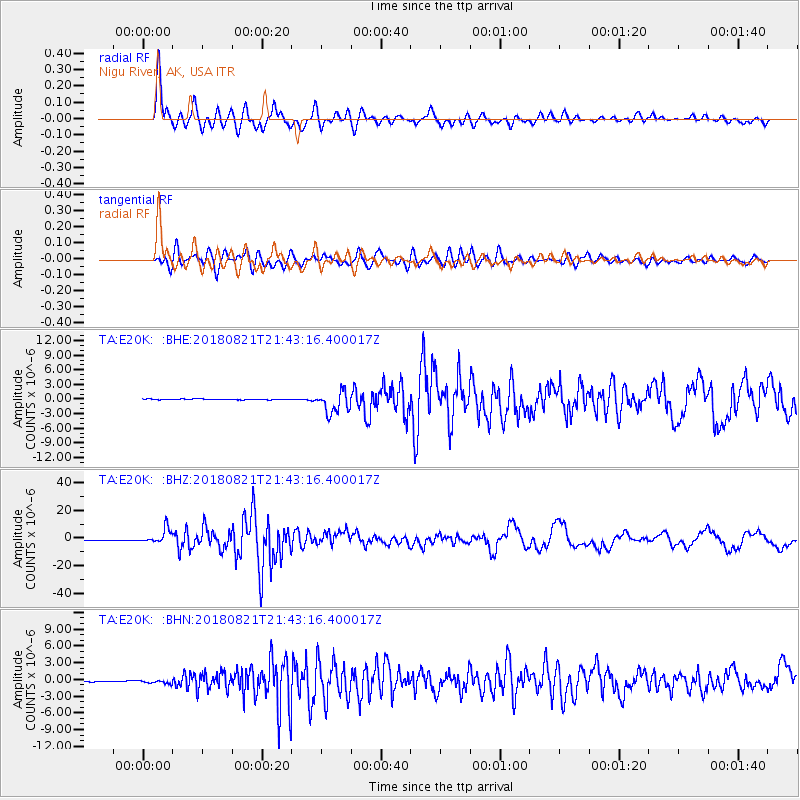
E20K Nigu River, AK, USA - Earthquake Result Viewer
*The percent match for this event was below the threshold and hence no stack was calculated.
| Earthquake location: |
Near Coast Of Venezuela |
| Earthquake latitude/longitude: |
10.9/-62.9 |
| Earthquake time(UTC): |
2018/08/21 (233) 21:31:46 GMT |
| Earthquake Depth: |
154 km |
| Earthquake Magnitude: |
7.3 Mww |
| Earthquake Catalog/Contributor: |
NEIC PDE/us |
|
| Network: |
TA USArray Transportable Network (new EarthScope stations) |
| Station: |
E20K Nigu River, AK, USA |
| Lat/Lon: |
68.26 N/156.19 W |
| Elevation: |
866 m |
|
| Distance: |
81.2 deg |
| Az: |
337.891 deg |
| Baz: |
82.893 deg |
| Ray Param: |
$rayparam |
*The percent match for this event was below the threshold and hence was not used in the summary stack. |
|
| Radial Match: |
95.729904 % |
| Radial Bump: |
400 |
| Transverse Match: |
89.90906 % |
| Transverse Bump: |
400 |
| SOD ConfigId: |
13570011 |
| Insert Time: |
2019-04-30 22:32:17.677 +0000 |
| GWidth: |
2.5 |
| Max Bumps: |
400 |
| Tol: |
0.001 |
|
Signal To Noise
| Channel | StoN | STA | LTA |
| TA:E20K: :BHZ:20180821T21:43:16.400017Z | 32.310604 | 5.1951024E-6 | 1.6078629E-7 |
| TA:E20K: :BHN:20180821T21:43:16.400017Z | 1.7792302 | 3.4254435E-7 | 1.9252391E-7 |
| TA:E20K: :BHE:20180821T21:43:16.400017Z | 18.905228 | 1.665764E-6 | 8.8111285E-8 |
| Arrivals |
| Ps | |
| PpPs | |
| PsPs/PpSs | |


