You are here: Home > Network List > TA - USArray Transportable Network (new EarthScope stations) Stations List
> Station G31M Satah River, YT, CAN > Earthquake Result Viewer
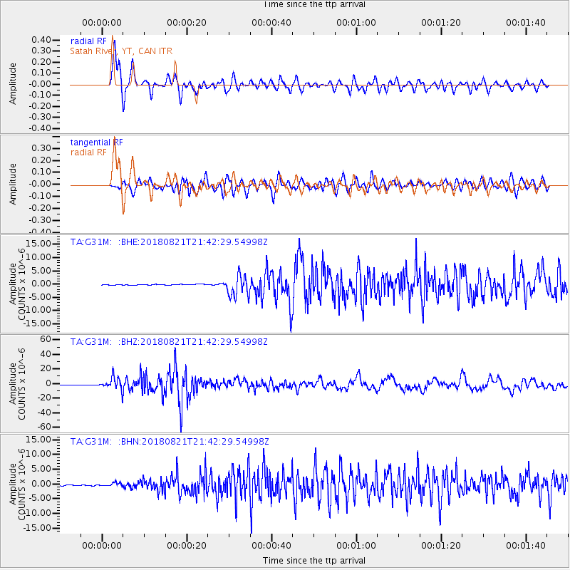
G31M Satah River, YT, CAN - Earthquake Result Viewer
*The percent match for this event was below the threshold and hence no stack was calculated.
| Earthquake location: |
Near Coast Of Venezuela |
| Earthquake latitude/longitude: |
10.9/-62.9 |
| Earthquake time(UTC): |
2018/08/21 (233) 21:31:46 GMT |
| Earthquake Depth: |
154 km |
| Earthquake Magnitude: |
7.3 Mww |
| Earthquake Catalog/Contributor: |
NEIC PDE/us |
|
| Network: |
TA USArray Transportable Network (new EarthScope stations) |
| Station: |
G31M Satah River, YT, CAN |
| Lat/Lon: |
66.92 N/134.27 W |
| Elevation: |
61 m |
|
| Distance: |
72.8 deg |
| Az: |
336.98 deg |
| Baz: |
102.967 deg |
| Ray Param: |
$rayparam |
*The percent match for this event was below the threshold and hence was not used in the summary stack. |
|
| Radial Match: |
90.67908 % |
| Radial Bump: |
400 |
| Transverse Match: |
81.93187 % |
| Transverse Bump: |
400 |
| SOD ConfigId: |
13570011 |
| Insert Time: |
2019-04-30 22:32:45.055 +0000 |
| GWidth: |
2.5 |
| Max Bumps: |
400 |
| Tol: |
0.001 |
|
Signal To Noise
| Channel | StoN | STA | LTA |
| TA:G31M: :BHZ:20180821T21:42:29.54998Z | 43.671085 | 7.963423E-6 | 1.8234999E-7 |
| TA:G31M: :BHN:20180821T21:42:29.54998Z | 3.7365184 | 5.71773E-7 | 1.5302292E-7 |
| TA:G31M: :BHE:20180821T21:42:29.54998Z | 21.351324 | 2.7538695E-6 | 1.2897887E-7 |
| Arrivals |
| Ps | |
| PpPs | |
| PsPs/PpSs | |


