You are here: Home > Network List > TA - USArray Transportable Network (new EarthScope stations) Stations List
> Station J26L Joseph Creek, AK, USA > Earthquake Result Viewer
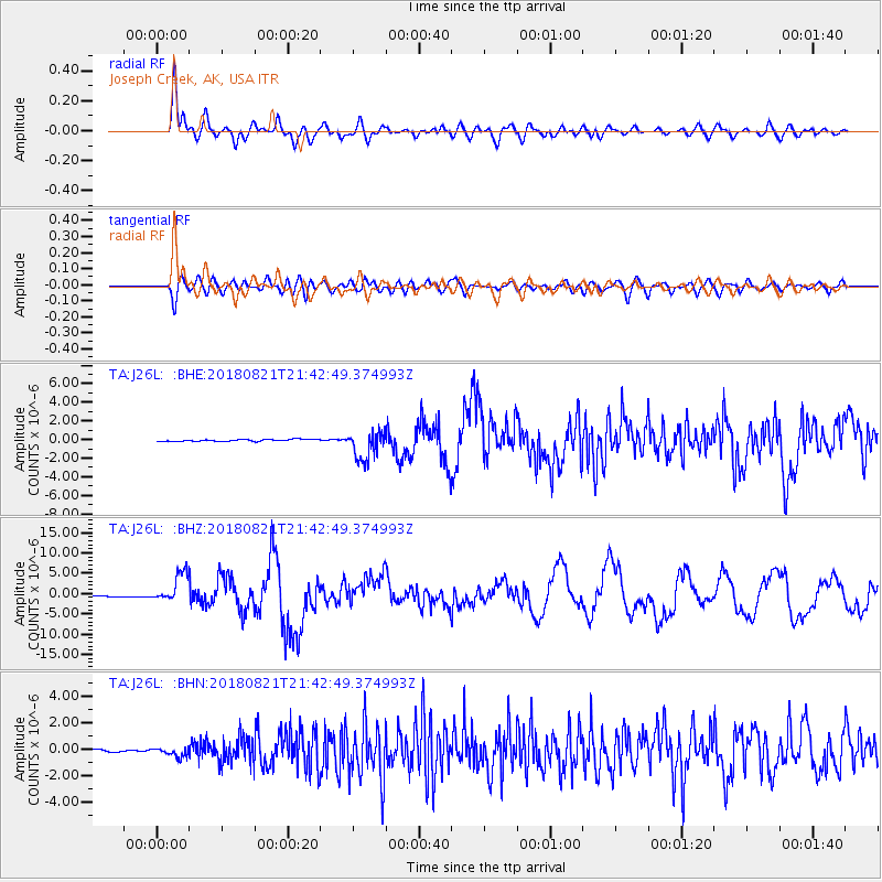
J26L Joseph Creek, AK, USA - Earthquake Result Viewer
*The percent match for this event was below the threshold and hence no stack was calculated.
| Earthquake location: |
Near Coast Of Venezuela |
| Earthquake latitude/longitude: |
10.9/-62.9 |
| Earthquake time(UTC): |
2018/08/21 (233) 21:31:46 GMT |
| Earthquake Depth: |
154 km |
| Earthquake Magnitude: |
7.3 Mww |
| Earthquake Catalog/Contributor: |
NEIC PDE/us |
|
| Network: |
TA USArray Transportable Network (new EarthScope stations) |
| Station: |
J26L Joseph Creek, AK, USA |
| Lat/Lon: |
64.50 N/143.56 W |
| Elevation: |
1144 m |
|
| Distance: |
76.3 deg |
| Az: |
333.914 deg |
| Baz: |
93.684 deg |
| Ray Param: |
$rayparam |
*The percent match for this event was below the threshold and hence was not used in the summary stack. |
|
| Radial Match: |
91.06224 % |
| Radial Bump: |
400 |
| Transverse Match: |
73.56204 % |
| Transverse Bump: |
400 |
| SOD ConfigId: |
13570011 |
| Insert Time: |
2019-04-30 22:33:07.709 +0000 |
| GWidth: |
2.5 |
| Max Bumps: |
400 |
| Tol: |
0.001 |
|
Signal To Noise
| Channel | StoN | STA | LTA |
| TA:J26L: :BHZ:20180821T21:42:49.374993Z | 24.95963 | 3.706349E-6 | 1.4849375E-7 |
| TA:J26L: :BHN:20180821T21:42:49.374993Z | 4.4610705 | 3.4666283E-7 | 7.770845E-8 |
| TA:J26L: :BHE:20180821T21:42:49.374993Z | 14.488596 | 1.4065286E-6 | 9.707832E-8 |
| Arrivals |
| Ps | |
| PpPs | |
| PsPs/PpSs | |


