You are here: Home > Network List > TA - USArray Transportable Network (new EarthScope stations) Stations List
> Station R33M Jennings River, BC, CAN > Earthquake Result Viewer
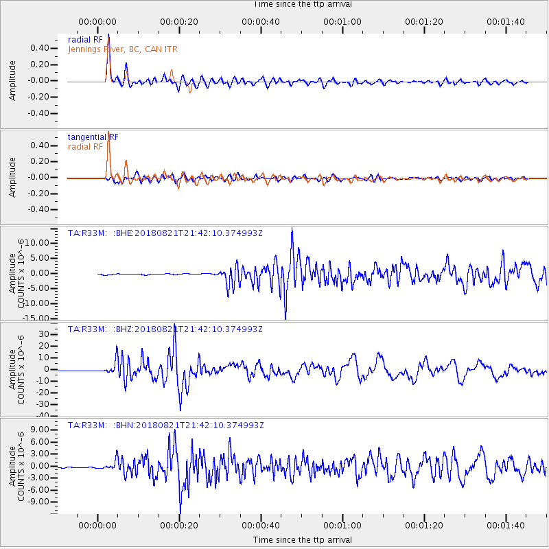
R33M Jennings River, BC, CAN - Earthquake Result Viewer
*The percent match for this event was below the threshold and hence no stack was calculated.
| Earthquake location: |
Near Coast Of Venezuela |
| Earthquake latitude/longitude: |
10.9/-62.9 |
| Earthquake time(UTC): |
2018/08/21 (233) 21:31:46 GMT |
| Earthquake Depth: |
154 km |
| Earthquake Magnitude: |
7.3 Mww |
| Earthquake Catalog/Contributor: |
NEIC PDE/us |
|
| Network: |
TA USArray Transportable Network (new EarthScope stations) |
| Station: |
R33M Jennings River, BC, CAN |
| Lat/Lon: |
59.39 N/130.97 W |
| Elevation: |
1437 m |
|
| Distance: |
69.6 deg |
| Az: |
329.575 deg |
| Baz: |
103.529 deg |
| Ray Param: |
$rayparam |
*The percent match for this event was below the threshold and hence was not used in the summary stack. |
|
| Radial Match: |
96.68337 % |
| Radial Bump: |
385 |
| Transverse Match: |
89.11864 % |
| Transverse Bump: |
400 |
| SOD ConfigId: |
13570011 |
| Insert Time: |
2019-04-30 22:35:34.506 +0000 |
| GWidth: |
2.5 |
| Max Bumps: |
400 |
| Tol: |
0.001 |
|
Signal To Noise
| Channel | StoN | STA | LTA |
| TA:R33M: :BHZ:20180821T21:42:10.374993Z | 26.462208 | 5.921014E-6 | 2.2375357E-7 |
| TA:R33M: :BHN:20180821T21:42:10.374993Z | 7.9651723 | 1.2286796E-6 | 1.542565E-7 |
| TA:R33M: :BHE:20180821T21:42:10.374993Z | 13.730292 | 2.1568958E-6 | 1.570903E-7 |
| Arrivals |
| Ps | |
| PpPs | |
| PsPs/PpSs | |


