You are here: Home > Network List > TA - USArray Transportable Network (new EarthScope stations) Stations List
> Station G31M Satah River, YT, CAN > Earthquake Result Viewer
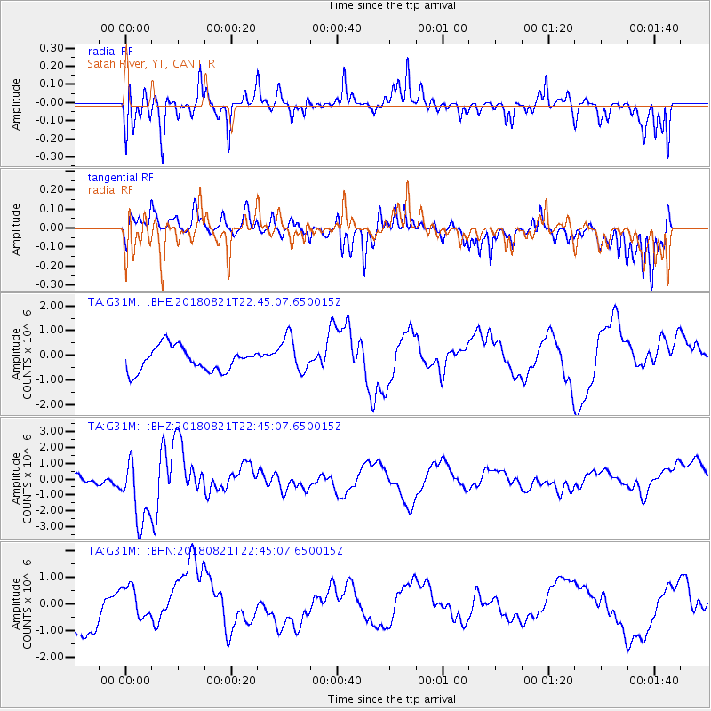
G31M Satah River, YT, CAN - Earthquake Result Viewer
*The percent match for this event was below the threshold and hence no stack was calculated.
| Earthquake location: |
Vanuatu Islands |
| Earthquake latitude/longitude: |
-16.0/168.2 |
| Earthquake time(UTC): |
2018/08/21 (233) 22:32:27 GMT |
| Earthquake Depth: |
13 km |
| Earthquake Magnitude: |
6.5 Mww |
| Earthquake Catalog/Contributor: |
NEIC PDE/us |
|
| Network: |
TA USArray Transportable Network (new EarthScope stations) |
| Station: |
G31M Satah River, YT, CAN |
| Lat/Lon: |
66.92 N/134.27 W |
| Elevation: |
61 m |
|
| Distance: |
92.8 deg |
| Az: |
19.46 deg |
| Baz: |
234.362 deg |
| Ray Param: |
$rayparam |
*The percent match for this event was below the threshold and hence was not used in the summary stack. |
|
| Radial Match: |
68.58536 % |
| Radial Bump: |
400 |
| Transverse Match: |
53.050636 % |
| Transverse Bump: |
391 |
| SOD ConfigId: |
13570011 |
| Insert Time: |
2019-04-30 22:44:55.326 +0000 |
| GWidth: |
2.5 |
| Max Bumps: |
400 |
| Tol: |
0.001 |
|
Signal To Noise
| Channel | StoN | STA | LTA |
| TA:G31M: :BHZ:20180821T22:45:07.650015Z | 2.231152 | 2.1810877E-6 | 9.775611E-7 |
| TA:G31M: :BHN:20180821T22:45:07.650015Z | 0.8921353 | 6.719348E-7 | 7.5317587E-7 |
| TA:G31M: :BHE:20180821T22:45:07.650015Z | 1.5323422 | 7.450984E-7 | 4.8624804E-7 |
| Arrivals |
| Ps | |
| PpPs | |
| PsPs/PpSs | |


