You are here: Home > Network List > TA - USArray Transportable Network (new EarthScope stations) Stations List
> Station M16K Timber Creek, AK, USA > Earthquake Result Viewer
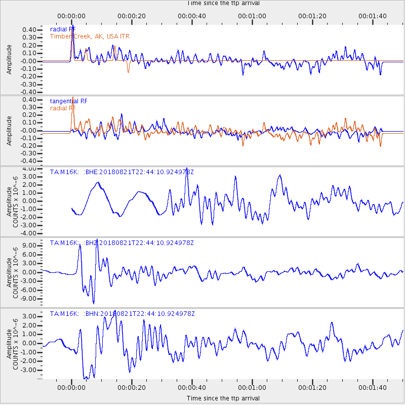
M16K Timber Creek, AK, USA - Earthquake Result Viewer
*The percent match for this event was below the threshold and hence no stack was calculated.
| Earthquake location: |
Vanuatu Islands |
| Earthquake latitude/longitude: |
-16.0/168.2 |
| Earthquake time(UTC): |
2018/08/21 (233) 22:32:27 GMT |
| Earthquake Depth: |
13 km |
| Earthquake Magnitude: |
6.5 Mww |
| Earthquake Catalog/Contributor: |
NEIC PDE/us |
|
| Network: |
TA USArray Transportable Network (new EarthScope stations) |
| Station: |
M16K Timber Creek, AK, USA |
| Lat/Lon: |
61.02 N/158.96 W |
| Elevation: |
394 m |
|
| Distance: |
81.2 deg |
| Az: |
15.521 deg |
| Baz: |
211.902 deg |
| Ray Param: |
$rayparam |
*The percent match for this event was below the threshold and hence was not used in the summary stack. |
|
| Radial Match: |
55.014515 % |
| Radial Bump: |
400 |
| Transverse Match: |
43.16133 % |
| Transverse Bump: |
384 |
| SOD ConfigId: |
13570011 |
| Insert Time: |
2019-04-30 22:45:28.577 +0000 |
| GWidth: |
2.5 |
| Max Bumps: |
400 |
| Tol: |
0.001 |
|
Signal To Noise
| Channel | StoN | STA | LTA |
| TA:M16K: :BHZ:20180821T22:44:10.924978Z | 3.9047084 | 4.368123E-6 | 1.118681E-6 |
| TA:M16K: :BHN:20180821T22:44:10.924978Z | 1.1735011 | 1.881484E-6 | 1.6033081E-6 |
| TA:M16K: :BHE:20180821T22:44:10.924978Z | 0.9896792 | 1.2625925E-6 | 1.2757594E-6 |
| Arrivals |
| Ps | |
| PpPs | |
| PsPs/PpSs | |


