You are here: Home > Network List > CI - Caltech Regional Seismic Network Stations List
> Station MPM Manuel Prospect Mine, California, USA > Earthquake Result Viewer
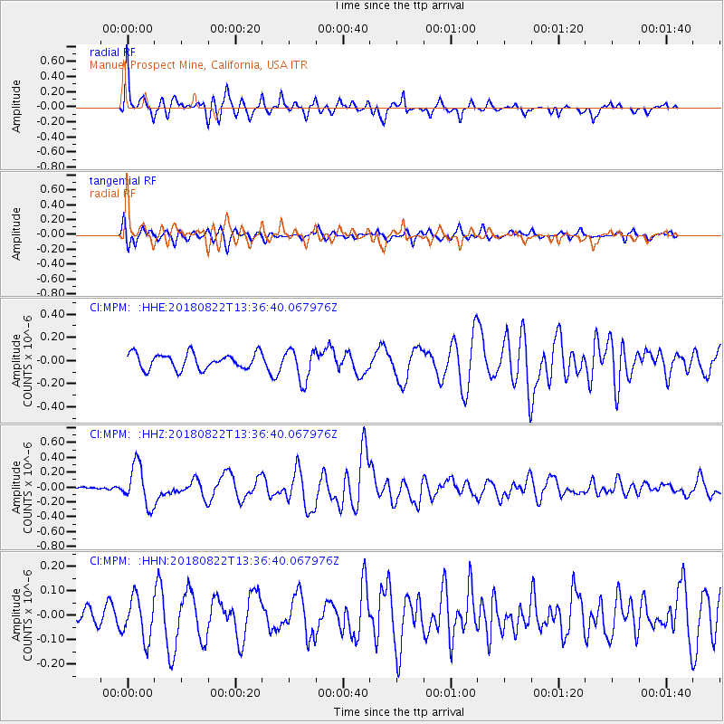
MPM Manuel Prospect Mine, California, USA - Earthquake Result Viewer
*The percent match for this event was below the threshold and hence no stack was calculated.
| Earthquake location: |
Near Coast Of Venezuela |
| Earthquake latitude/longitude: |
10.6/-62.9 |
| Earthquake time(UTC): |
2018/08/22 (234) 13:27:47 GMT |
| Earthquake Depth: |
98 km |
| Earthquake Magnitude: |
5.8 Mww |
| Earthquake Catalog/Contributor: |
NEIC PDE/us |
|
| Network: |
CI Caltech Regional Seismic Network |
| Station: |
MPM Manuel Prospect Mine, California, USA |
| Lat/Lon: |
36.06 N/117.49 W |
| Elevation: |
185 m |
|
| Distance: |
55.3 deg |
| Az: |
306.606 deg |
| Baz: |
103.081 deg |
| Ray Param: |
$rayparam |
*The percent match for this event was below the threshold and hence was not used in the summary stack. |
|
| Radial Match: |
74.596306 % |
| Radial Bump: |
400 |
| Transverse Match: |
58.743732 % |
| Transverse Bump: |
400 |
| SOD ConfigId: |
13570011 |
| Insert Time: |
2019-04-30 22:59:13.683 +0000 |
| GWidth: |
2.5 |
| Max Bumps: |
400 |
| Tol: |
0.001 |
|
Signal To Noise
| Channel | StoN | STA | LTA |
| CI:MPM: :HHZ:20180822T13:36:40.067976Z | 5.5690374 | 2.7814963E-7 | 4.994573E-8 |
| CI:MPM: :HHN:20180822T13:36:40.067976Z | 1.0068349 | 8.598913E-8 | 8.540539E-8 |
| CI:MPM: :HHE:20180822T13:36:40.067976Z | 2.0933795 | 1.3967575E-7 | 6.672261E-8 |
| Arrivals |
| Ps | |
| PpPs | |
| PsPs/PpSs | |


