You are here: Home > Network List > TA - USArray Transportable Network (new EarthScope stations) Stations List
> Station S21A Coal Bank Pass, Durango, CO, USA > Earthquake Result Viewer
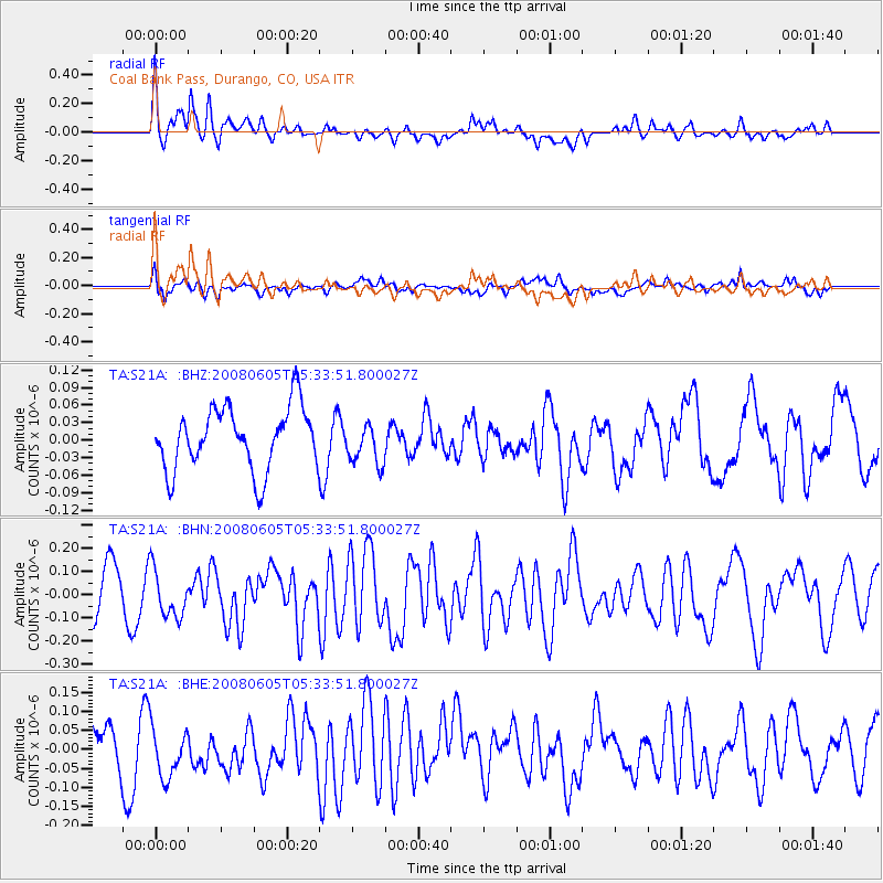
S21A Coal Bank Pass, Durango, CO, USA - Earthquake Result Viewer
*The percent match for this event was below the threshold and hence no stack was calculated.
| Earthquake location: |
West Chile Rise |
| Earthquake latitude/longitude: |
-38.9/-91.6 |
| Earthquake time(UTC): |
2008/06/05 (157) 05:22:26 GMT |
| Earthquake Depth: |
7.0 km |
| Earthquake Magnitude: |
5.5 MS, 5.3 MB, 5.8 MW, 5.8 MW |
| Earthquake Catalog/Contributor: |
WHDF/NEIC |
|
| Network: |
TA USArray Transportable Network (new EarthScope stations) |
| Station: |
S21A Coal Bank Pass, Durango, CO, USA |
| Lat/Lon: |
37.66 N/107.79 W |
| Elevation: |
2723 m |
|
| Distance: |
77.6 deg |
| Az: |
346.914 deg |
| Baz: |
167.132 deg |
| Ray Param: |
$rayparam |
*The percent match for this event was below the threshold and hence was not used in the summary stack. |
|
| Radial Match: |
61.51232 % |
| Radial Bump: |
400 |
| Transverse Match: |
39.730694 % |
| Transverse Bump: |
400 |
| SOD ConfigId: |
2504 |
| Insert Time: |
2010-03-06 14:38:51.237 +0000 |
| GWidth: |
2.5 |
| Max Bumps: |
400 |
| Tol: |
0.001 |
|
Signal To Noise
| Channel | StoN | STA | LTA |
| TA:S21A: :BHN:20080605T05:33:51.800027Z | 1.14118 | 1.02116935E-7 | 8.948363E-8 |
| TA:S21A: :BHE:20080605T05:33:51.800027Z | 1.2675947 | 7.830871E-8 | 6.1777406E-8 |
| TA:S21A: :BHZ:20080605T05:33:51.800027Z | 0.65306157 | 3.4921722E-8 | 5.3473862E-8 |
| Arrivals |
| Ps | |
| PpPs | |
| PsPs/PpSs | |


