You are here: Home > Network List > TA - USArray Transportable Network (new EarthScope stations) Stations List
> Station 121A Cookes Peak, Deming, NM, USA > Earthquake Result Viewer
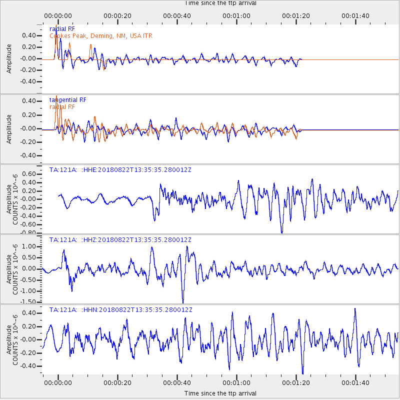
121A Cookes Peak, Deming, NM, USA - Earthquake Result Viewer
*The percent match for this event was below the threshold and hence no stack was calculated.
| Earthquake location: |
Near Coast Of Venezuela |
| Earthquake latitude/longitude: |
10.6/-62.9 |
| Earthquake time(UTC): |
2018/08/22 (234) 13:27:47 GMT |
| Earthquake Depth: |
98 km |
| Earthquake Magnitude: |
5.8 Mww |
| Earthquake Catalog/Contributor: |
NEIC PDE/us |
|
| Network: |
TA USArray Transportable Network (new EarthScope stations) |
| Station: |
121A Cookes Peak, Deming, NM, USA |
| Lat/Lon: |
32.53 N/107.79 W |
| Elevation: |
1652 m |
|
| Distance: |
46.7 deg |
| Az: |
304.981 deg |
| Baz: |
107.51 deg |
| Ray Param: |
$rayparam |
*The percent match for this event was below the threshold and hence was not used in the summary stack. |
|
| Radial Match: |
73.850464 % |
| Radial Bump: |
400 |
| Transverse Match: |
70.80247 % |
| Transverse Bump: |
399 |
| SOD ConfigId: |
13570011 |
| Insert Time: |
2019-04-30 23:06:15.791 +0000 |
| GWidth: |
2.5 |
| Max Bumps: |
400 |
| Tol: |
0.001 |
|
Signal To Noise
| Channel | StoN | STA | LTA |
| TA:121A: :HHZ:20180822T13:35:35.280012Z | 5.3103657 | 4.516559E-7 | 8.5051745E-8 |
| TA:121A: :HHN:20180822T13:35:35.280012Z | 2.5926619 | 1.4872153E-7 | 5.7362485E-8 |
| TA:121A: :HHE:20180822T13:35:35.280012Z | 3.146521 | 2.3911673E-7 | 7.5994E-8 |
| Arrivals |
| Ps | |
| PpPs | |
| PsPs/PpSs | |


