You are here: Home > Network List > UW - Pacific Northwest Regional Seismic Network Stations List
> Station UMAT Pilot Rock, OR, USA > Earthquake Result Viewer
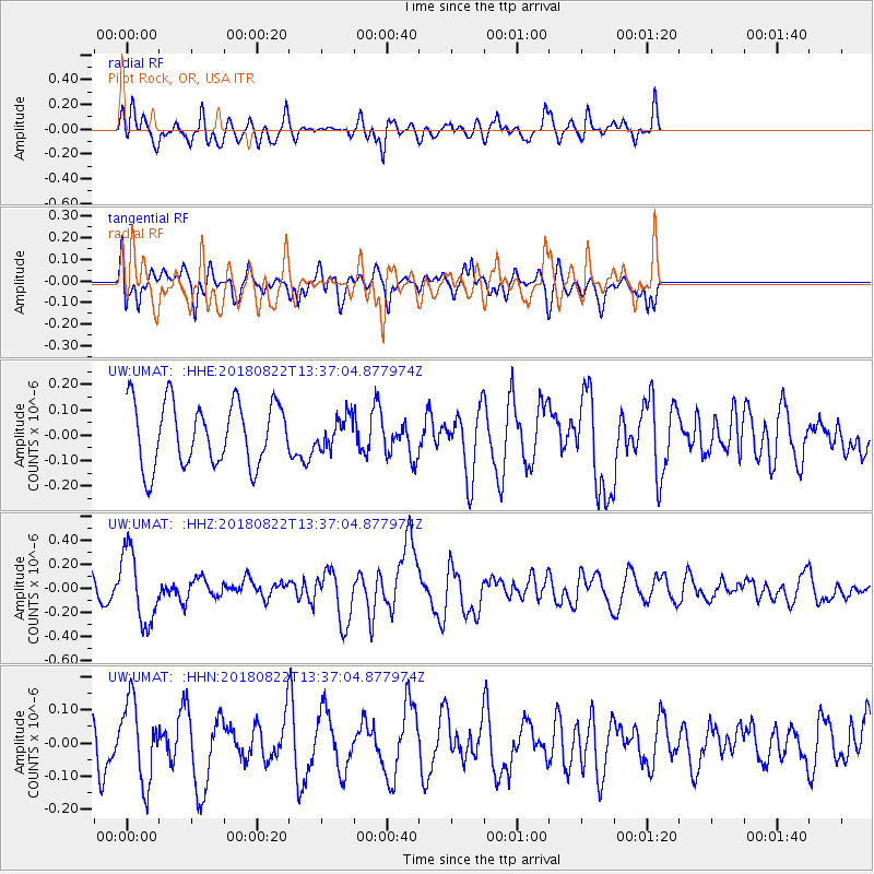
UMAT Pilot Rock, OR, USA - Earthquake Result Viewer
*The percent match for this event was below the threshold and hence no stack was calculated.
| Earthquake location: |
Near Coast Of Venezuela |
| Earthquake latitude/longitude: |
10.6/-62.9 |
| Earthquake time(UTC): |
2018/08/22 (234) 13:27:47 GMT |
| Earthquake Depth: |
98 km |
| Earthquake Magnitude: |
5.8 Mww |
| Earthquake Catalog/Contributor: |
NEIC PDE/us |
|
| Network: |
UW Pacific Northwest Regional Seismic Network |
| Station: |
UMAT Pilot Rock, OR, USA |
| Lat/Lon: |
45.29 N/118.96 W |
| Elevation: |
1318 m |
|
| Distance: |
58.9 deg |
| Az: |
316.845 deg |
| Baz: |
107.697 deg |
| Ray Param: |
$rayparam |
*The percent match for this event was below the threshold and hence was not used in the summary stack. |
|
| Radial Match: |
53.252728 % |
| Radial Bump: |
400 |
| Transverse Match: |
64.45508 % |
| Transverse Bump: |
400 |
| SOD ConfigId: |
13570011 |
| Insert Time: |
2019-04-30 23:09:36.071 +0000 |
| GWidth: |
2.5 |
| Max Bumps: |
400 |
| Tol: |
0.001 |
|
Signal To Noise
| Channel | StoN | STA | LTA |
| UW:UMAT: :HHZ:20180822T13:37:04.877974Z | 3.7532136 | 3.000102E-7 | 7.993422E-8 |
| UW:UMAT: :HHN:20180822T13:37:04.877974Z | 1.9731201 | 1.2100762E-7 | 6.132805E-8 |
| UW:UMAT: :HHE:20180822T13:37:04.877974Z | 0.55211246 | 6.6838176E-8 | 1.2105899E-7 |
| Arrivals |
| Ps | |
| PpPs | |
| PsPs/PpSs | |


