You are here: Home > Network List > US - United States National Seismic Network Stations List
> Station HAWA Hanford, Washington, USA > Earthquake Result Viewer
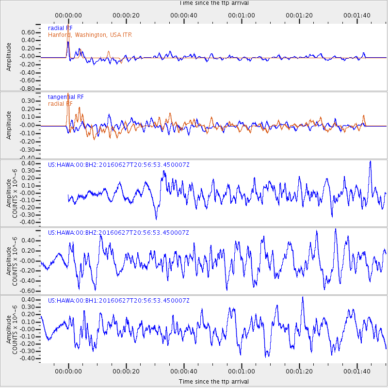
HAWA Hanford, Washington, USA - Earthquake Result Viewer
*The percent match for this event was below the threshold and hence no stack was calculated.
| Earthquake location: |
Oaxaca, Mexico |
| Earthquake latitude/longitude: |
16.6/-97.8 |
| Earthquake time(UTC): |
2016/06/27 (179) 20:50:34 GMT |
| Earthquake Depth: |
19 km |
| Earthquake Magnitude: |
5.7 MWW, 5.5 MWB |
| Earthquake Catalog/Contributor: |
NEIC PDE/NEIC COMCAT |
|
| Network: |
US United States National Seismic Network |
| Station: |
HAWA Hanford, Washington, USA |
| Lat/Lon: |
46.39 N/119.53 W |
| Elevation: |
364 m |
|
| Distance: |
34.8 deg |
| Az: |
333.355 deg |
| Baz: |
141.583 deg |
| Ray Param: |
$rayparam |
*The percent match for this event was below the threshold and hence was not used in the summary stack. |
|
| Radial Match: |
51.29331 % |
| Radial Bump: |
400 |
| Transverse Match: |
50.609814 % |
| Transverse Bump: |
400 |
| SOD ConfigId: |
1634031 |
| Insert Time: |
2016-07-11 20:53:33.066 +0000 |
| GWidth: |
2.5 |
| Max Bumps: |
400 |
| Tol: |
0.001 |
|
Signal To Noise
| Channel | StoN | STA | LTA |
| US:HAWA:00:BHZ:20160627T20:56:53.450007Z | 2.8178713 | 2.4976617E-7 | 8.863647E-8 |
| US:HAWA:00:BH1:20160627T20:56:53.450007Z | 1.7070785 | 1.3972861E-7 | 8.1852484E-8 |
| US:HAWA:00:BH2:20160627T20:56:53.450007Z | 3.2024653 | 2.000814E-7 | 6.2477305E-8 |
| Arrivals |
| Ps | |
| PpPs | |
| PsPs/PpSs | |


