You are here: Home > Network List > US - United States National Seismic Network Stations List
> Station MSO Missoula, Montana, USA > Earthquake Result Viewer
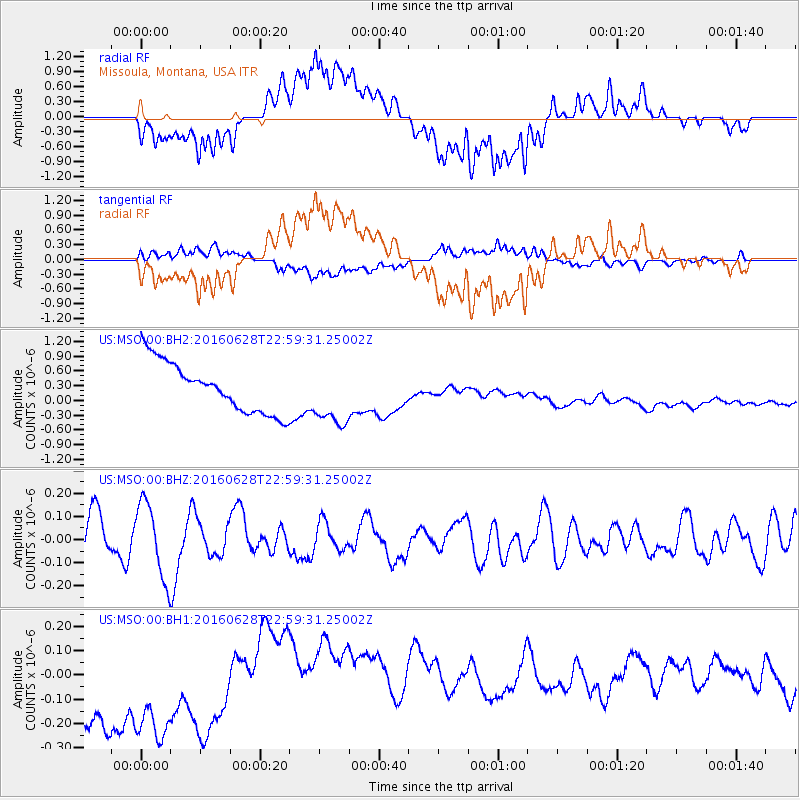
MSO Missoula, Montana, USA - Earthquake Result Viewer
*The percent match for this event was below the threshold and hence no stack was calculated.
| Earthquake location: |
Vanuatu Islands |
| Earthquake latitude/longitude: |
-14.6/166.5 |
| Earthquake time(UTC): |
2016/06/28 (180) 22:46:46 GMT |
| Earthquake Depth: |
10 km |
| Earthquake Magnitude: |
5.5 MB |
| Earthquake Catalog/Contributor: |
NEIC PDE/NEIC COMCAT |
|
| Network: |
US United States National Seismic Network |
| Station: |
MSO Missoula, Montana, USA |
| Lat/Lon: |
46.83 N/113.94 W |
| Elevation: |
1264 m |
|
| Distance: |
93.5 deg |
| Az: |
42.569 deg |
| Baz: |
252.515 deg |
| Ray Param: |
$rayparam |
*The percent match for this event was below the threshold and hence was not used in the summary stack. |
|
| Radial Match: |
27.938284 % |
| Radial Bump: |
400 |
| Transverse Match: |
30.074137 % |
| Transverse Bump: |
400 |
| SOD ConfigId: |
1634031 |
| Insert Time: |
2016-07-12 22:51:55.879 +0000 |
| GWidth: |
2.5 |
| Max Bumps: |
400 |
| Tol: |
0.001 |
|
Signal To Noise
| Channel | StoN | STA | LTA |
| US:MSO:00:BHZ:20160628T22:59:31.25002Z | 2.2090635 | 1.6344556E-7 | 7.398862E-8 |
| US:MSO:00:BH1:20160628T22:59:31.25002Z | 1.2542837 | 4.161281E-7 | 3.3176556E-7 |
| US:MSO:00:BH2:20160628T22:59:31.25002Z | 1.235242 | 6.2754077E-7 | 5.080306E-7 |
| Arrivals |
| Ps | |
| PpPs | |
| PsPs/PpSs | |


