You are here: Home > Network List > TA - USArray Transportable Network (new EarthScope stations) Stations List
> Station U19A Dine' College, Tsaile, AZ, USA > Earthquake Result Viewer
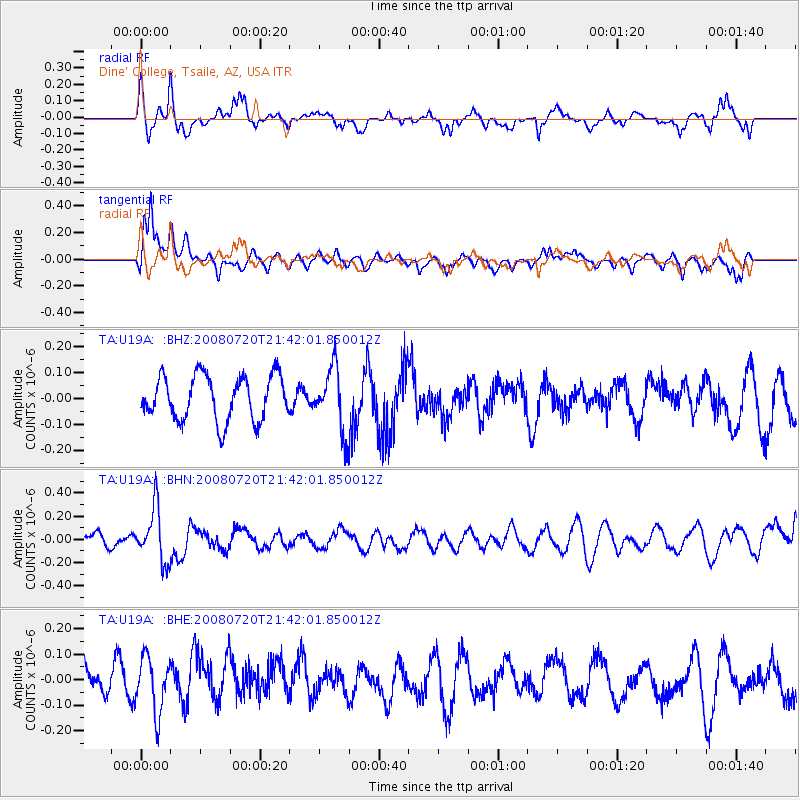
U19A Dine' College, Tsaile, AZ, USA - Earthquake Result Viewer
*The percent match for this event was below the threshold and hence no stack was calculated.
| Earthquake location: |
Bonin Islands, Japan Region |
| Earthquake latitude/longitude: |
27.8/139.6 |
| Earthquake time(UTC): |
2008/07/20 (202) 21:30:29 GMT |
| Earthquake Depth: |
481 km |
| Earthquake Magnitude: |
5.8 MW, 5.1 MB, 5.8 MW |
| Earthquake Catalog/Contributor: |
WHDF/NEIC |
|
| Network: |
TA USArray Transportable Network (new EarthScope stations) |
| Station: |
U19A Dine' College, Tsaile, AZ, USA |
| Lat/Lon: |
36.29 N/109.21 W |
| Elevation: |
2166 m |
|
| Distance: |
89.2 deg |
| Az: |
48.887 deg |
| Baz: |
304.276 deg |
| Ray Param: |
$rayparam |
*The percent match for this event was below the threshold and hence was not used in the summary stack. |
|
| Radial Match: |
61.57187 % |
| Radial Bump: |
368 |
| Transverse Match: |
53.02303 % |
| Transverse Bump: |
345 |
| SOD ConfigId: |
2504 |
| Insert Time: |
2010-03-06 14:42:17.954 +0000 |
| GWidth: |
2.5 |
| Max Bumps: |
400 |
| Tol: |
0.001 |
|
Signal To Noise
| Channel | StoN | STA | LTA |
| TA:U19A: :BHN:20080720T21:42:01.850012Z | 3.262908 | 2.3084345E-7 | 7.074777E-8 |
| TA:U19A: :BHE:20080720T21:42:01.850012Z | 1.6872183 | 1.0765896E-7 | 6.380856E-8 |
| TA:U19A: :BHZ:20080720T21:42:01.850012Z | 1.4278413 | 1.2126823E-7 | 8.4931166E-8 |
| Arrivals |
| Ps | |
| PpPs | |
| PsPs/PpSs | |


