You are here: Home > Network List > TA - USArray Transportable Network (new EarthScope stations) Stations List
> Station J26L Joseph Creek, AK, USA > Earthquake Result Viewer
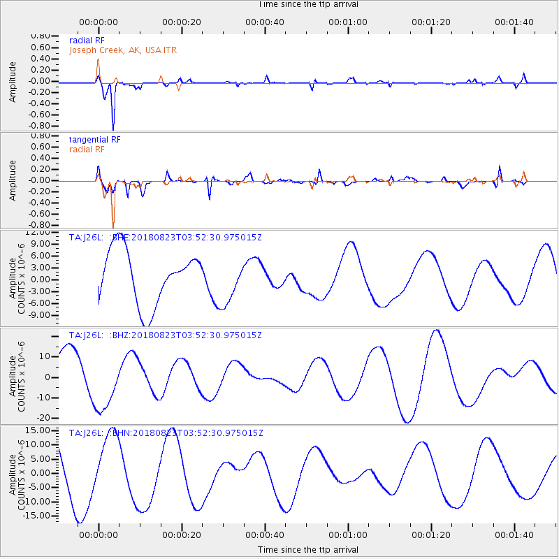
J26L Joseph Creek, AK, USA - Earthquake Result Viewer
*The percent match for this event was below the threshold and hence no stack was calculated.
| Earthquake location: |
Fiji Islands Region |
| Earthquake latitude/longitude: |
-18.2/-178.2 |
| Earthquake time(UTC): |
2018/08/23 (235) 03:41:16 GMT |
| Earthquake Depth: |
544 km |
| Earthquake Magnitude: |
5.5 mb |
| Earthquake Catalog/Contributor: |
NEIC PDE/us |
|
| Network: |
TA USArray Transportable Network (new EarthScope stations) |
| Station: |
J26L Joseph Creek, AK, USA |
| Lat/Lon: |
64.50 N/143.56 W |
| Elevation: |
1144 m |
|
| Distance: |
86.6 deg |
| Az: |
14.272 deg |
| Baz: |
212.787 deg |
| Ray Param: |
$rayparam |
*The percent match for this event was below the threshold and hence was not used in the summary stack. |
|
| Radial Match: |
83.19336 % |
| Radial Bump: |
326 |
| Transverse Match: |
65.702774 % |
| Transverse Bump: |
390 |
| SOD ConfigId: |
13570011 |
| Insert Time: |
2019-04-30 23:41:14.739 +0000 |
| GWidth: |
2.5 |
| Max Bumps: |
400 |
| Tol: |
0.001 |
|
Signal To Noise
| Channel | StoN | STA | LTA |
| TA:J26L: :BHZ:20180823T03:52:30.975015Z | 1.2484293 | 1.378198E-5 | 1.1039456E-5 |
| TA:J26L: :BHN:20180823T03:52:30.975015Z | 1.7086471 | 1.1786809E-5 | 6.898328E-6 |
| TA:J26L: :BHE:20180823T03:52:30.975015Z | 0.84496045 | 5.7549073E-6 | 6.8108598E-6 |
| Arrivals |
| Ps | |
| PpPs | |
| PsPs/PpSs | |


