You are here: Home > Network List > TA - USArray Transportable Network (new EarthScope stations) Stations List
> Station R33M Jennings River, BC, CAN > Earthquake Result Viewer
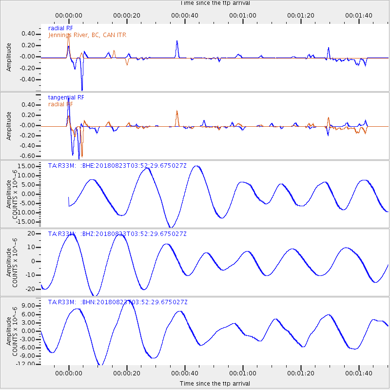
R33M Jennings River, BC, CAN - Earthquake Result Viewer
*The percent match for this event was below the threshold and hence no stack was calculated.
| Earthquake location: |
Fiji Islands Region |
| Earthquake latitude/longitude: |
-18.2/-178.2 |
| Earthquake time(UTC): |
2018/08/23 (235) 03:41:16 GMT |
| Earthquake Depth: |
544 km |
| Earthquake Magnitude: |
5.5 mb |
| Earthquake Catalog/Contributor: |
NEIC PDE/us |
|
| Network: |
TA USArray Transportable Network (new EarthScope stations) |
| Station: |
R33M Jennings River, BC, CAN |
| Lat/Lon: |
59.39 N/130.97 W |
| Elevation: |
1437 m |
|
| Distance: |
86.3 deg |
| Az: |
22.115 deg |
| Baz: |
224.392 deg |
| Ray Param: |
$rayparam |
*The percent match for this event was below the threshold and hence was not used in the summary stack. |
|
| Radial Match: |
88.491646 % |
| Radial Bump: |
329 |
| Transverse Match: |
91.28623 % |
| Transverse Bump: |
400 |
| SOD ConfigId: |
13570011 |
| Insert Time: |
2019-04-30 23:41:28.956 +0000 |
| GWidth: |
2.5 |
| Max Bumps: |
400 |
| Tol: |
0.001 |
|
Signal To Noise
| Channel | StoN | STA | LTA |
| TA:R33M: :BHZ:20180823T03:52:29.675027Z | 1.6574357 | 1.883244E-5 | 1.13623955E-5 |
| TA:R33M: :BHN:20180823T03:52:29.675027Z | 1.5690464 | 7.4140494E-6 | 4.7251947E-6 |
| TA:R33M: :BHE:20180823T03:52:29.675027Z | 1.3693271 | 8.938009E-6 | 6.5273002E-6 |
| Arrivals |
| Ps | |
| PpPs | |
| PsPs/PpSs | |


