You are here: Home > Network List > UW - Pacific Northwest Regional Seismic Network Stations List
> Station LCCR Mulino, OR, USA > Earthquake Result Viewer
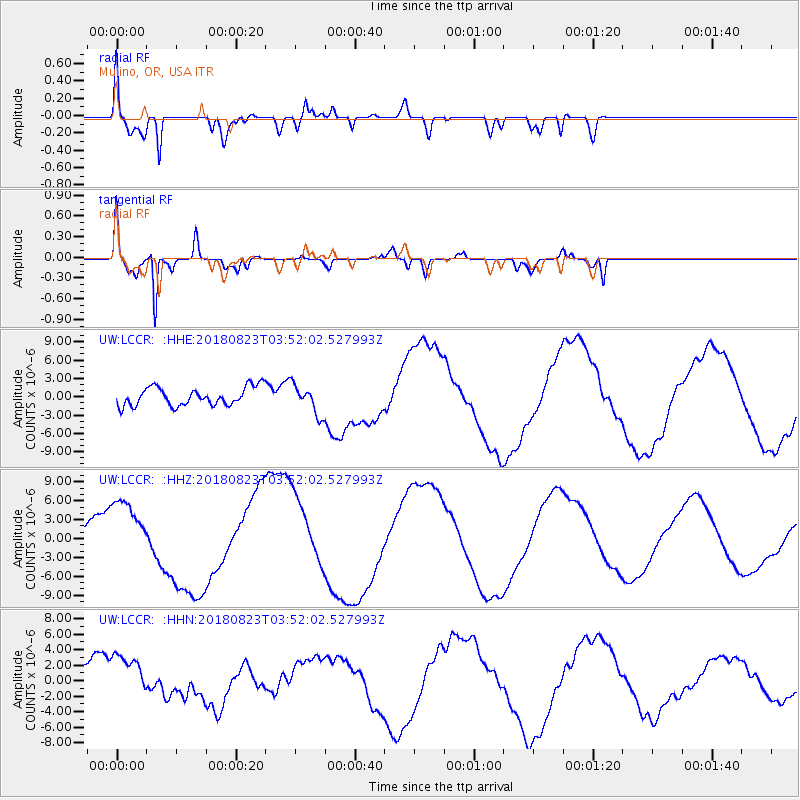
LCCR Mulino, OR, USA - Earthquake Result Viewer
*The percent match for this event was below the threshold and hence no stack was calculated.
| Earthquake location: |
Fiji Islands Region |
| Earthquake latitude/longitude: |
-18.2/-178.2 |
| Earthquake time(UTC): |
2018/08/23 (235) 03:41:16 GMT |
| Earthquake Depth: |
544 km |
| Earthquake Magnitude: |
5.5 mb |
| Earthquake Catalog/Contributor: |
NEIC PDE/us |
|
| Network: |
UW Pacific Northwest Regional Seismic Network |
| Station: |
LCCR Mulino, OR, USA |
| Lat/Lon: |
45.21 N/122.48 W |
| Elevation: |
273 m |
|
| Distance: |
80.8 deg |
| Az: |
36.285 deg |
| Baz: |
232.743 deg |
| Ray Param: |
$rayparam |
*The percent match for this event was below the threshold and hence was not used in the summary stack. |
|
| Radial Match: |
83.5478 % |
| Radial Bump: |
400 |
| Transverse Match: |
87.96504 % |
| Transverse Bump: |
400 |
| SOD ConfigId: |
13570011 |
| Insert Time: |
2019-04-30 23:42:16.989 +0000 |
| GWidth: |
2.5 |
| Max Bumps: |
400 |
| Tol: |
0.001 |
|
Signal To Noise
| Channel | StoN | STA | LTA |
| UW:LCCR: :HHZ:20180823T03:52:02.527993Z | 4.057766 | 5.3082867E-6 | 1.3081797E-6 |
| UW:LCCR: :HHN:20180823T03:52:02.527993Z | 2.1025953 | 3.1523614E-6 | 1.4992715E-6 |
| UW:LCCR: :HHE:20180823T03:52:02.527993Z | 1.6343621 | 2.4295966E-6 | 1.4865718E-6 |
| Arrivals |
| Ps | |
| PpPs | |
| PsPs/PpSs | |


