You are here: Home > Network List > TA - USArray Transportable Network (new EarthScope stations) Stations List
> Station S19A Harvey Farm, Monticello, UT, USA > Earthquake Result Viewer
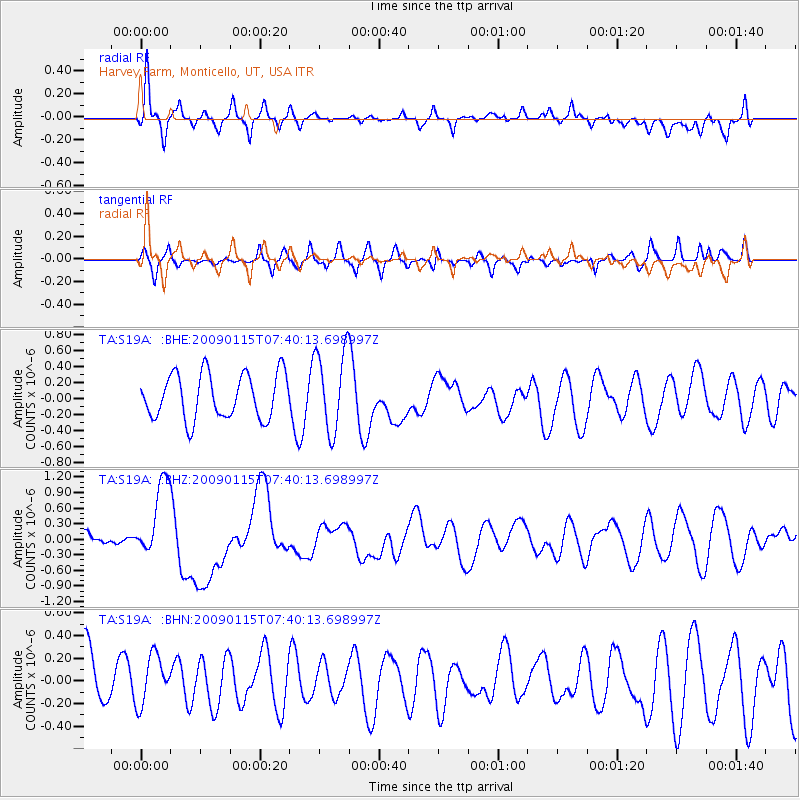
S19A Harvey Farm, Monticello, UT, USA - Earthquake Result Viewer
*The percent match for this event was below the threshold and hence no stack was calculated.
| Earthquake location: |
Southeast Of Loyalty Islands |
| Earthquake latitude/longitude: |
-22.4/170.6 |
| Earthquake time(UTC): |
2009/01/15 (015) 07:27:20 GMT |
| Earthquake Depth: |
27 km |
| Earthquake Magnitude: |
5.8 MB, 6.5 MS, 6.7 MW, 6.6 MW |
| Earthquake Catalog/Contributor: |
WHDF/NEIC |
|
| Network: |
TA USArray Transportable Network (new EarthScope stations) |
| Station: |
S19A Harvey Farm, Monticello, UT, USA |
| Lat/Lon: |
37.75 N/109.14 W |
| Elevation: |
2059 m |
|
| Distance: |
96.1 deg |
| Az: |
51.78 deg |
| Baz: |
246.562 deg |
| Ray Param: |
$rayparam |
*The percent match for this event was below the threshold and hence was not used in the summary stack. |
|
| Radial Match: |
73.392334 % |
| Radial Bump: |
400 |
| Transverse Match: |
39.53592 % |
| Transverse Bump: |
359 |
| SOD ConfigId: |
2834 |
| Insert Time: |
2010-03-06 14:46:51.583 +0000 |
| GWidth: |
2.5 |
| Max Bumps: |
400 |
| Tol: |
0.001 |
|
Signal To Noise
| Channel | StoN | STA | LTA |
| TA:S19A: :BHZ:20090115T07:40:13.698997Z | 2.984556 | 7.5501157E-7 | 2.5297282E-7 |
| TA:S19A: :BHN:20090115T07:40:13.698997Z | 0.9175386 | 2.7881302E-7 | 3.0387062E-7 |
| TA:S19A: :BHE:20090115T07:40:13.698997Z | 1.8178955 | 5.079851E-7 | 2.794358E-7 |
| Arrivals |
| Ps | |
| PpPs | |
| PsPs/PpSs | |


