You are here: Home > Network List > TA - USArray Transportable Network (new EarthScope stations) Stations List
> Station S19A Harvey Farm, Monticello, UT, USA > Earthquake Result Viewer
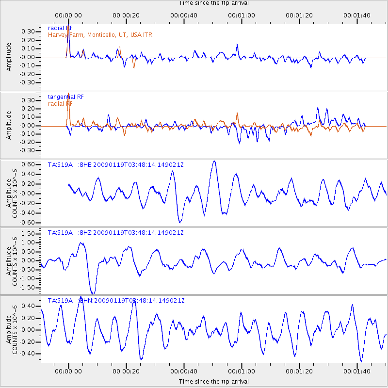
S19A Harvey Farm, Monticello, UT, USA - Earthquake Result Viewer
*The percent match for this event was below the threshold and hence no stack was calculated.
| Earthquake location: |
Southeast Of Loyalty Islands |
| Earthquake latitude/longitude: |
-22.6/170.9 |
| Earthquake time(UTC): |
2009/01/19 (019) 03:35:18 GMT |
| Earthquake Depth: |
12 km |
| Earthquake Magnitude: |
5.7 MB, 6.4 MS, 6.5 MW, 6.5 MW |
| Earthquake Catalog/Contributor: |
WHDF/NEIC |
|
| Network: |
TA USArray Transportable Network (new EarthScope stations) |
| Station: |
S19A Harvey Farm, Monticello, UT, USA |
| Lat/Lon: |
37.75 N/109.14 W |
| Elevation: |
2059 m |
|
| Distance: |
96.0 deg |
| Az: |
51.712 deg |
| Baz: |
246.211 deg |
| Ray Param: |
$rayparam |
*The percent match for this event was below the threshold and hence was not used in the summary stack. |
|
| Radial Match: |
63.689713 % |
| Radial Bump: |
400 |
| Transverse Match: |
29.735596 % |
| Transverse Bump: |
400 |
| SOD ConfigId: |
2658 |
| Insert Time: |
2010-03-06 14:47:00.735 +0000 |
| GWidth: |
2.5 |
| Max Bumps: |
400 |
| Tol: |
0.001 |
|
Signal To Noise
| Channel | StoN | STA | LTA |
| TA:S19A: :BHZ:20090119T03:48:14.149021Z | 3.869988 | 5.8467265E-7 | 1.5107867E-7 |
| TA:S19A: :BHN:20090119T03:48:14.149021Z | 1.9387698 | 3.98873E-7 | 2.057351E-7 |
| TA:S19A: :BHE:20090119T03:48:14.149021Z | 0.91412205 | 1.0942714E-7 | 1.1970737E-7 |
| Arrivals |
| Ps | |
| PpPs | |
| PsPs/PpSs | |


