You are here: Home > Network List > TA - USArray Transportable Network (new EarthScope stations) Stations List
> Station S19A Harvey Farm, Monticello, UT, USA > Earthquake Result Viewer
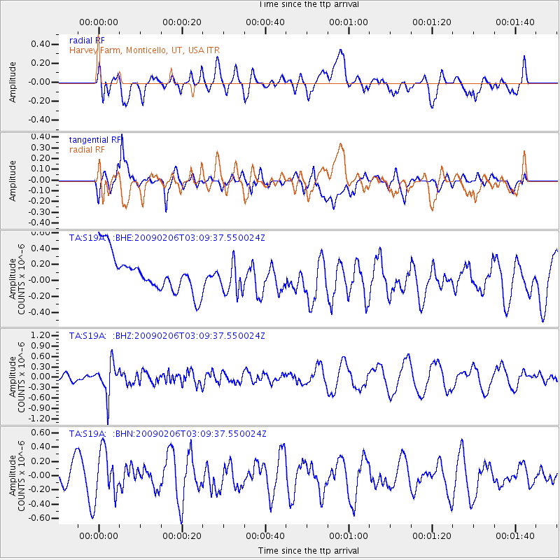
S19A Harvey Farm, Monticello, UT, USA - Earthquake Result Viewer
*The percent match for this event was below the threshold and hence no stack was calculated.
| Earthquake location: |
Near Coast Of Northern Chile |
| Earthquake latitude/longitude: |
-28.0/-71.1 |
| Earthquake time(UTC): |
2009/02/06 (037) 02:58:35 GMT |
| Earthquake Depth: |
52 km |
| Earthquake Magnitude: |
5.5 MB |
| Earthquake Catalog/Contributor: |
WHDF/NEIC |
|
| Network: |
TA USArray Transportable Network (new EarthScope stations) |
| Station: |
S19A Harvey Farm, Monticello, UT, USA |
| Lat/Lon: |
37.75 N/109.14 W |
| Elevation: |
2059 m |
|
| Distance: |
74.5 deg |
| Az: |
329.543 deg |
| Baz: |
145.564 deg |
| Ray Param: |
$rayparam |
*The percent match for this event was below the threshold and hence was not used in the summary stack. |
|
| Radial Match: |
45.742676 % |
| Radial Bump: |
400 |
| Transverse Match: |
58.843998 % |
| Transverse Bump: |
400 |
| SOD ConfigId: |
2658 |
| Insert Time: |
2010-03-06 14:47:08.004 +0000 |
| GWidth: |
2.5 |
| Max Bumps: |
400 |
| Tol: |
0.001 |
|
Signal To Noise
| Channel | StoN | STA | LTA |
| TA:S19A: :BHZ:20090206T03:09:37.550024Z | 3.4654133 | 4.6537363E-7 | 1.3429094E-7 |
| TA:S19A: :BHN:20090206T03:09:37.550024Z | 1.5220789 | 3.195727E-7 | 2.0995805E-7 |
| TA:S19A: :BHE:20090206T03:09:37.550024Z | 0.8688951 | 2.0296888E-7 | 2.335942E-7 |
| Arrivals |
| Ps | |
| PpPs | |
| PsPs/PpSs | |


