You are here: Home > Network List > UW - Pacific Northwest Regional Seismic Network Stations List
> Station LCCR Mulino, OR, USA > Earthquake Result Viewer
LCCR Mulino, OR, USA - Earthquake Result Viewer
*The percent match for this event was below the threshold and hence no stack was calculated.
| Earthquake location: |
Peru-Brazil Border Region |
| Earthquake latitude/longitude: |
-11.0/-70.8 |
| Earthquake time(UTC): |
2018/08/24 (236) 09:04:06 GMT |
| Earthquake Depth: |
609 km |
| Earthquake Magnitude: |
7.1 Mww |
| Earthquake Catalog/Contributor: |
NEIC PDE/us |
|
| Network: |
UW Pacific Northwest Regional Seismic Network |
| Station: |
LCCR Mulino, OR, USA |
| Lat/Lon: |
45.21 N/122.48 W |
| Elevation: |
273 m |
|
| Distance: |
72.8 deg |
| Az: |
324.515 deg |
| Baz: |
126.281 deg |
| Ray Param: |
$rayparam |
*The percent match for this event was below the threshold and hence was not used in the summary stack. |
|
| Radial Match: |
78.415146 % |
| Radial Bump: |
400 |
| Transverse Match: |
72.926674 % |
| Transverse Bump: |
400 |
| SOD ConfigId: |
13570011 |
| Insert Time: |
2019-04-30 23:57:22.431 +0000 |
| GWidth: |
2.5 |
| Max Bumps: |
400 |
| Tol: |
0.001 |
|
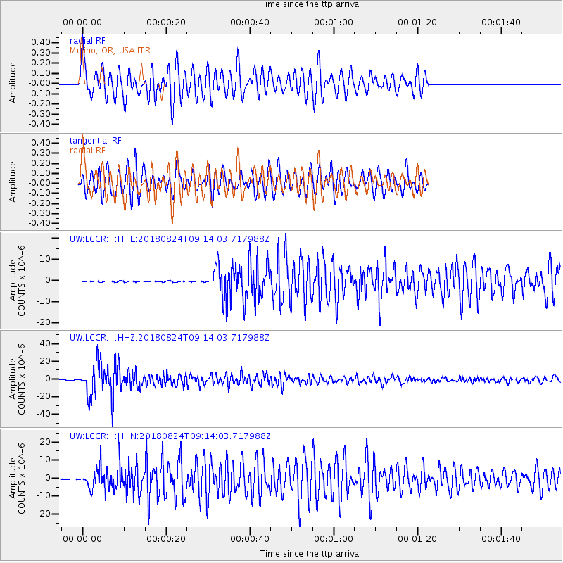
Signal To Noise
| Channel | StoN | STA | LTA |
| UW:LCCR: :HHZ:20180824T09:14:03.717988Z | 131.54575 | 1.7968237E-5 | 1.3659309E-7 |
| UW:LCCR: :HHN:20180824T09:14:03.717988Z | 17.287806 | 5.1752977E-6 | 2.9936115E-7 |
| UW:LCCR: :HHE:20180824T09:14:03.717988Z | 30.18713 | 7.5869725E-6 | 2.5133136E-7 |
| Arrivals |
| Ps | |
| PpPs | |
| PsPs/PpSs | |


