You are here: Home > Network List > TA - USArray Transportable Network (new EarthScope stations) Stations List
> Station S19A Harvey Farm, Monticello, UT, USA > Earthquake Result Viewer
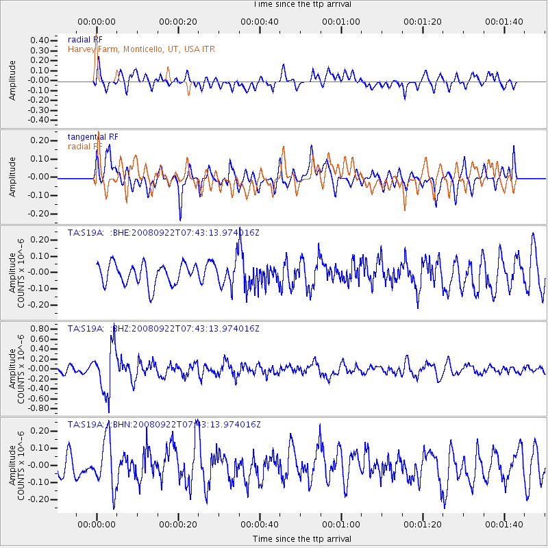
S19A Harvey Farm, Monticello, UT, USA - Earthquake Result Viewer
*The percent match for this event was below the threshold and hence no stack was calculated.
| Earthquake location: |
Hokkaido, Japan Region |
| Earthquake latitude/longitude: |
41.6/140.4 |
| Earthquake time(UTC): |
2008/09/22 (266) 07:31:59 GMT |
| Earthquake Depth: |
149 km |
| Earthquake Magnitude: |
5.7 MW, 5.3 MB, 5.6 MW |
| Earthquake Catalog/Contributor: |
WHDF/NEIC |
|
| Network: |
TA USArray Transportable Network (new EarthScope stations) |
| Station: |
S19A Harvey Farm, Monticello, UT, USA |
| Lat/Lon: |
37.75 N/109.14 W |
| Elevation: |
2059 m |
|
| Distance: |
78.7 deg |
| Az: |
49.25 deg |
| Baz: |
314.193 deg |
| Ray Param: |
$rayparam |
*The percent match for this event was below the threshold and hence was not used in the summary stack. |
|
| Radial Match: |
50.755585 % |
| Radial Bump: |
400 |
| Transverse Match: |
54.31942 % |
| Transverse Bump: |
400 |
| SOD ConfigId: |
2560 |
| Insert Time: |
2010-03-06 14:47:30.930 +0000 |
| GWidth: |
2.5 |
| Max Bumps: |
400 |
| Tol: |
0.001 |
|
Signal To Noise
| Channel | StoN | STA | LTA |
| TA:S19A: :BHZ:20080922T07:43:13.974016Z | 5.4696646 | 4.666141E-7 | 8.530946E-8 |
| TA:S19A: :BHN:20080922T07:43:13.974016Z | 1.7870002 | 1.4941071E-7 | 8.360979E-8 |
| TA:S19A: :BHE:20080922T07:43:13.974016Z | 1.2228342 | 7.838624E-8 | 6.41021E-8 |
| Arrivals |
| Ps | |
| PpPs | |
| PsPs/PpSs | |


