You are here: Home > Network List > TA - USArray Transportable Network (new EarthScope stations) Stations List
> Station H16K Elim, AK, USA > Earthquake Result Viewer
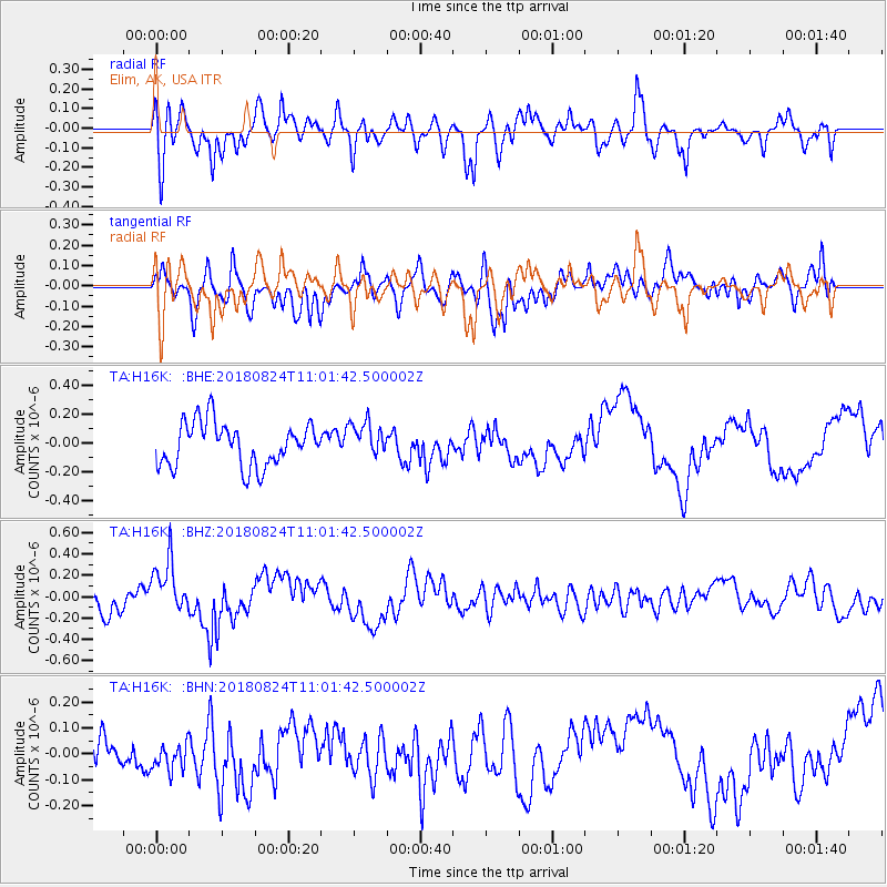
H16K Elim, AK, USA - Earthquake Result Viewer
*The percent match for this event was below the threshold and hence no stack was calculated.
| Earthquake location: |
Andaman Islands, India Region |
| Earthquake latitude/longitude: |
10.6/91.7 |
| Earthquake time(UTC): |
2018/08/24 (236) 10:49:27 GMT |
| Earthquake Depth: |
10 km |
| Earthquake Magnitude: |
5.5 mb |
| Earthquake Catalog/Contributor: |
NEIC PDE/us |
|
| Network: |
TA USArray Transportable Network (new EarthScope stations) |
| Station: |
H16K Elim, AK, USA |
| Lat/Lon: |
64.64 N/162.24 W |
| Elevation: |
216 m |
|
| Distance: |
87.3 deg |
| Az: |
24.481 deg |
| Baz: |
288.909 deg |
| Ray Param: |
$rayparam |
*The percent match for this event was below the threshold and hence was not used in the summary stack. |
|
| Radial Match: |
68.93787 % |
| Radial Bump: |
365 |
| Transverse Match: |
70.27188 % |
| Transverse Bump: |
400 |
| SOD ConfigId: |
13570011 |
| Insert Time: |
2019-05-01 00:02:10.714 +0000 |
| GWidth: |
2.5 |
| Max Bumps: |
400 |
| Tol: |
0.001 |
|
Signal To Noise
| Channel | StoN | STA | LTA |
| TA:H16K: :BHZ:20180824T11:01:42.500002Z | 2.5473516 | 2.534777E-7 | 9.950637E-8 |
| TA:H16K: :BHN:20180824T11:01:42.500002Z | 0.64684 | 5.3649675E-8 | 8.2941185E-8 |
| TA:H16K: :BHE:20180824T11:01:42.500002Z | 0.7983309 | 1.2008348E-7 | 1.5041817E-7 |
| Arrivals |
| Ps | |
| PpPs | |
| PsPs/PpSs | |


