You are here: Home > Network List > US - United States National Seismic Network Stations List
> Station EGMT Eagleton, Montana, USA > Earthquake Result Viewer
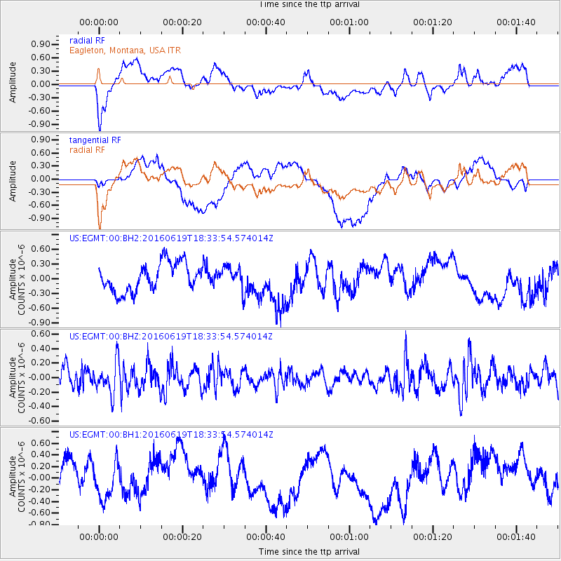
EGMT Eagleton, Montana, USA - Earthquake Result Viewer
*The percent match for this event was below the threshold and hence no stack was calculated.
| Earthquake location: |
Philippine Islands Region |
| Earthquake latitude/longitude: |
20.1/121.4 |
| Earthquake time(UTC): |
2016/06/19 (171) 18:20:50 GMT |
| Earthquake Depth: |
18 km |
| Earthquake Magnitude: |
5.6 MWW, 5.4 MWB |
| Earthquake Catalog/Contributor: |
NEIC PDE/NEIC COMCAT |
|
| Network: |
US United States National Seismic Network |
| Station: |
EGMT Eagleton, Montana, USA |
| Lat/Lon: |
48.02 N/109.75 W |
| Elevation: |
1055 m |
|
| Distance: |
98.2 deg |
| Az: |
31.88 deg |
| Baz: |
312.334 deg |
| Ray Param: |
$rayparam |
*The percent match for this event was below the threshold and hence was not used in the summary stack. |
|
| Radial Match: |
53.597996 % |
| Radial Bump: |
400 |
| Transverse Match: |
41.798298 % |
| Transverse Bump: |
400 |
| SOD ConfigId: |
1634031 |
| Insert Time: |
2016-07-18 15:44:12.238 +0000 |
| GWidth: |
2.5 |
| Max Bumps: |
400 |
| Tol: |
0.001 |
|
Signal To Noise
| Channel | StoN | STA | LTA |
| US:EGMT:00:BHZ:20160619T18:33:54.574014Z | 1.9557458 | 2.243169E-7 | 1.1469635E-7 |
| US:EGMT:00:BH1:20160619T18:33:54.574014Z | 0.76585597 | 2.8259416E-7 | 3.6899127E-7 |
| US:EGMT:00:BH2:20160619T18:33:54.574014Z | 0.7754959 | 2.2375522E-7 | 2.885318E-7 |
| Arrivals |
| Ps | |
| PpPs | |
| PsPs/PpSs | |


