You are here: Home > Network List > TA - USArray Transportable Network (new EarthScope stations) Stations List
> Station S17A Black Ridge (BLM), Bullfrog Basin, UT, USA > Earthquake Result Viewer
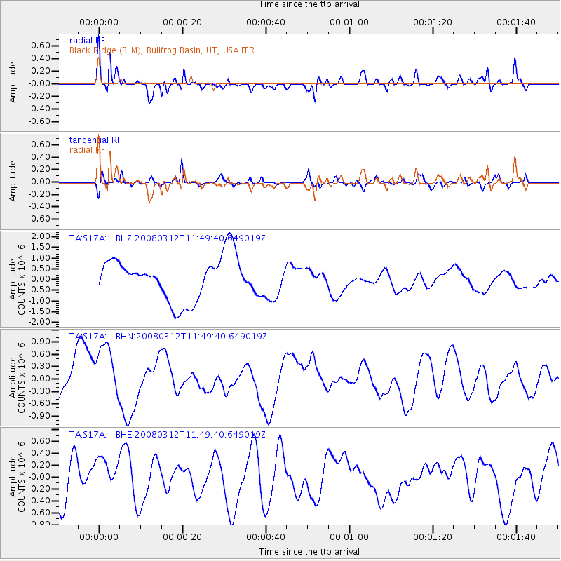
S17A Black Ridge (BLM), Bullfrog Basin, UT, USA - Earthquake Result Viewer
*The percent match for this event was below the threshold and hence no stack was calculated.
| Earthquake location: |
Vanuatu Islands |
| Earthquake latitude/longitude: |
-16.5/167.2 |
| Earthquake time(UTC): |
2008/03/12 (072) 11:36:55 GMT |
| Earthquake Depth: |
10 km |
| Earthquake Magnitude: |
5.6 MB, 6.3 MW |
| Earthquake Catalog/Contributor: |
WHDF/NEIC |
|
| Network: |
TA USArray Transportable Network (new EarthScope stations) |
| Station: |
S17A Black Ridge (BLM), Bullfrog Basin, UT, USA |
| Lat/Lon: |
37.64 N/110.80 W |
| Elevation: |
1373 m |
|
| Distance: |
93.8 deg |
| Az: |
51.989 deg |
| Baz: |
252.203 deg |
| Ray Param: |
$rayparam |
*The percent match for this event was below the threshold and hence was not used in the summary stack. |
|
| Radial Match: |
73.42722 % |
| Radial Bump: |
400 |
| Transverse Match: |
49.71569 % |
| Transverse Bump: |
354 |
| SOD ConfigId: |
2504 |
| Insert Time: |
2010-03-06 14:49:27.272 +0000 |
| GWidth: |
2.5 |
| Max Bumps: |
400 |
| Tol: |
0.001 |
|
Signal To Noise
| Channel | StoN | STA | LTA |
| TA:S17A: :BHN:20080312T11:49:40.649019Z | 1.1488476 | 7.75166E-7 | 6.7473354E-7 |
| TA:S17A: :BHE:20080312T11:49:40.649019Z | 0.6374195 | 2.7719932E-7 | 4.3487736E-7 |
| TA:S17A: :BHZ:20080312T11:49:40.649019Z | 1.9471698 | 1.7130853E-6 | 8.797822E-7 |
| Arrivals |
| Ps | |
| PpPs | |
| PsPs/PpSs | |


