You are here: Home > Network List > TA - USArray Transportable Network (new EarthScope stations) Stations List
> Station S17A Black Ridge (BLM), Bullfrog Basin, UT, USA > Earthquake Result Viewer
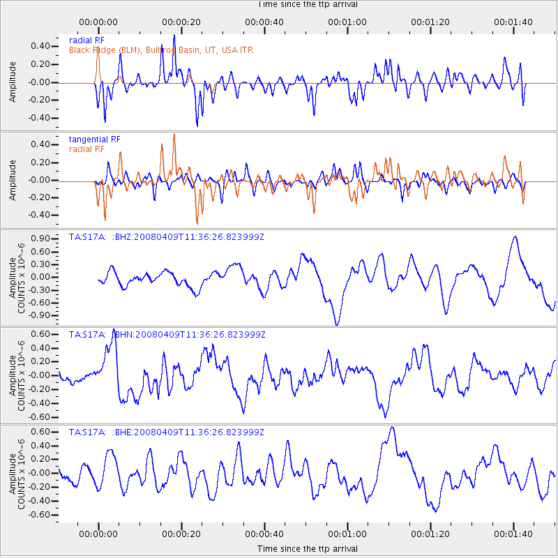
S17A Black Ridge (BLM), Bullfrog Basin, UT, USA - Earthquake Result Viewer
*The percent match for this event was below the threshold and hence no stack was calculated.
| Earthquake location: |
Loyalty Islands |
| Earthquake latitude/longitude: |
-20.2/168.9 |
| Earthquake time(UTC): |
2008/04/09 (100) 11:23:40 GMT |
| Earthquake Depth: |
35 km |
| Earthquake Magnitude: |
5.7 MB, 6.3 MW, 6.3 MW |
| Earthquake Catalog/Contributor: |
WHDF/NEIC |
|
| Network: |
TA USArray Transportable Network (new EarthScope stations) |
| Station: |
S17A Black Ridge (BLM), Bullfrog Basin, UT, USA |
| Lat/Lon: |
37.64 N/110.80 W |
| Elevation: |
1373 m |
|
| Distance: |
94.8 deg |
| Az: |
51.741 deg |
| Baz: |
248.291 deg |
| Ray Param: |
$rayparam |
*The percent match for this event was below the threshold and hence was not used in the summary stack. |
|
| Radial Match: |
66.16557 % |
| Radial Bump: |
370 |
| Transverse Match: |
54.70541 % |
| Transverse Bump: |
365 |
| SOD ConfigId: |
2504 |
| Insert Time: |
2010-03-06 14:50:13.249 +0000 |
| GWidth: |
2.5 |
| Max Bumps: |
400 |
| Tol: |
0.001 |
|
Signal To Noise
| Channel | StoN | STA | LTA |
| TA:S17A: :BHN:20080409T11:36:26.823999Z | 2.3736434 | 3.6189044E-7 | 1.5246201E-7 |
| TA:S17A: :BHE:20080409T11:36:26.823999Z | 1.7182887 | 2.4393037E-7 | 1.4196122E-7 |
| TA:S17A: :BHZ:20080409T11:36:26.823999Z | 1.7478396 | 2.8185184E-7 | 1.6125728E-7 |
| Arrivals |
| Ps | |
| PpPs | |
| PsPs/PpSs | |


