You are here: Home > Network List > TA - USArray Transportable Network (new EarthScope stations) Stations List
> Station S17A Black Ridge (BLM), Bullfrog Basin, UT, USA > Earthquake Result Viewer
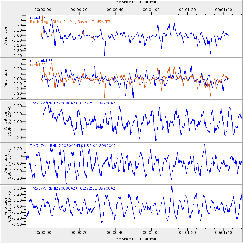
S17A Black Ridge (BLM), Bullfrog Basin, UT, USA - Earthquake Result Viewer
*The percent match for this event was below the threshold and hence no stack was calculated.
| Earthquake location: |
Loyalty Islands |
| Earthquake latitude/longitude: |
-20.1/168.7 |
| Earthquake time(UTC): |
2008/04/24 (115) 01:19:15 GMT |
| Earthquake Depth: |
35 km |
| Earthquake Magnitude: |
5.7 MW, 5.3 MS, 5.3 MB, 5.6 MW |
| Earthquake Catalog/Contributor: |
WHDF/NEIC |
|
| Network: |
TA USArray Transportable Network (new EarthScope stations) |
| Station: |
S17A Black Ridge (BLM), Bullfrog Basin, UT, USA |
| Lat/Lon: |
37.64 N/110.80 W |
| Elevation: |
1373 m |
|
| Distance: |
94.8 deg |
| Az: |
51.787 deg |
| Baz: |
248.498 deg |
| Ray Param: |
$rayparam |
*The percent match for this event was below the threshold and hence was not used in the summary stack. |
|
| Radial Match: |
53.781757 % |
| Radial Bump: |
400 |
| Transverse Match: |
62.30573 % |
| Transverse Bump: |
400 |
| SOD ConfigId: |
2504 |
| Insert Time: |
2010-03-06 14:50:19.986 +0000 |
| GWidth: |
2.5 |
| Max Bumps: |
400 |
| Tol: |
0.001 |
|
Signal To Noise
| Channel | StoN | STA | LTA |
| TA:S17A: :BHN:20080424T01:32:01.899004Z | 1.318815 | 1.1541269E-7 | 8.751242E-8 |
| TA:S17A: :BHE:20080424T01:32:01.899004Z | 1.006061 | 9.206793E-8 | 9.151327E-8 |
| TA:S17A: :BHZ:20080424T01:32:01.899004Z | 1.0368185 | 9.9524804E-8 | 9.599058E-8 |
| Arrivals |
| Ps | |
| PpPs | |
| PsPs/PpSs | |


