You are here: Home > Network List > AV - Alaska Volcano Observatory Stations List
> Station SPCR Ckakachatna River, Mount Spurr, Alaska > Earthquake Result Viewer
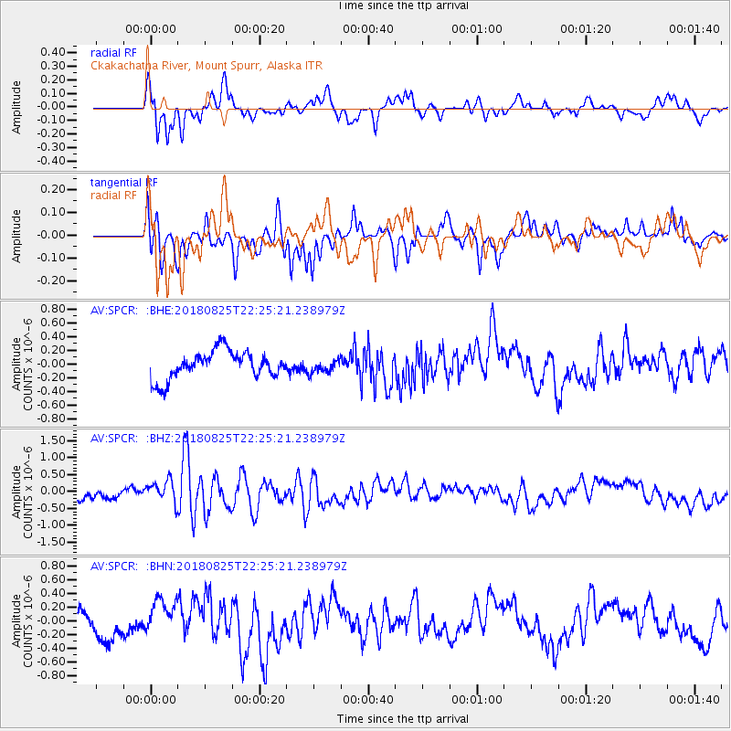
SPCR Ckakachatna River, Mount Spurr, Alaska - Earthquake Result Viewer
*The percent match for this event was below the threshold and hence no stack was calculated.
| Earthquake location: |
Western Iran |
| Earthquake latitude/longitude: |
34.7/46.2 |
| Earthquake time(UTC): |
2018/08/25 (237) 22:13:26 GMT |
| Earthquake Depth: |
10 km |
| Earthquake Magnitude: |
6.1 Mww |
| Earthquake Catalog/Contributor: |
NEIC PDE/us |
|
| Network: |
AV Alaska Volcano Observatory |
| Station: |
SPCR Ckakachatna River, Mount Spurr, Alaska |
| Lat/Lon: |
61.20 N/152.21 W |
| Elevation: |
984 m |
|
| Distance: |
83.3 deg |
| Az: |
8.863 deg |
| Baz: |
344.796 deg |
| Ray Param: |
$rayparam |
*The percent match for this event was below the threshold and hence was not used in the summary stack. |
|
| Radial Match: |
69.06905 % |
| Radial Bump: |
400 |
| Transverse Match: |
54.72434 % |
| Transverse Bump: |
400 |
| SOD ConfigId: |
13570011 |
| Insert Time: |
2019-05-01 00:20:01.698 +0000 |
| GWidth: |
2.5 |
| Max Bumps: |
400 |
| Tol: |
0.001 |
|
Signal To Noise
| Channel | StoN | STA | LTA |
| AV:SPCR: :BHZ:20180825T22:25:21.238979Z | 2.8877034 | 3.3973342E-7 | 1.17648305E-7 |
| AV:SPCR: :BHN:20180825T22:25:21.238979Z | 1.7061214 | 2.7837538E-7 | 1.6316271E-7 |
| AV:SPCR: :BHE:20180825T22:25:21.238979Z | 0.45562798 | 8.982969E-8 | 1.9715579E-7 |
| Arrivals |
| Ps | |
| PpPs | |
| PsPs/PpSs | |


