You are here: Home > Network List > CN - Canadian National Seismograph Network Stations List
> Station INK INUVIK, NT > Earthquake Result Viewer
INK INUVIK, NT - Earthquake Result Viewer
*The percent match for this event was below the threshold and hence no stack was calculated.
| Earthquake location: |
Western Iran |
| Earthquake latitude/longitude: |
34.7/46.2 |
| Earthquake time(UTC): |
2018/08/25 (237) 22:13:26 GMT |
| Earthquake Depth: |
10 km |
| Earthquake Magnitude: |
6.1 Mww |
| Earthquake Catalog/Contributor: |
NEIC PDE/us |
|
| Network: |
CN Canadian National Seismograph Network |
| Station: |
INK INUVIK, NT |
| Lat/Lon: |
68.31 N/133.53 W |
| Elevation: |
44 m |
|
| Distance: |
77.3 deg |
| Az: |
359.9 deg |
| Baz: |
0.221 deg |
| Ray Param: |
$rayparam |
*The percent match for this event was below the threshold and hence was not used in the summary stack. |
|
| Radial Match: |
76.79792 % |
| Radial Bump: |
400 |
| Transverse Match: |
64.14092 % |
| Transverse Bump: |
400 |
| SOD ConfigId: |
13570011 |
| Insert Time: |
2019-05-01 00:20:48.681 +0000 |
| GWidth: |
2.5 |
| Max Bumps: |
400 |
| Tol: |
0.001 |
|
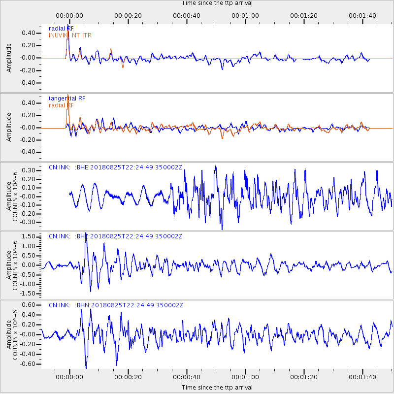
Signal To Noise
| Channel | StoN | STA | LTA |
| CN:INK: :BHZ:20180825T22:24:49.350002Z | 3.183921 | 2.8100484E-7 | 8.825747E-8 |
| CN:INK: :BHN:20180825T22:24:49.350002Z | 2.7385547 | 1.5141526E-7 | 5.5290208E-8 |
| CN:INK: :BHE:20180825T22:24:49.350002Z | 0.7993567 | 5.915678E-8 | 7.4005484E-8 |
| Arrivals |
| Ps | |
| PpPs | |
| PsPs/PpSs | |


