You are here: Home > Network List > TA - USArray Transportable Network (new EarthScope stations) Stations List
> Station D23K Nanushuk River, AK USA > Earthquake Result Viewer
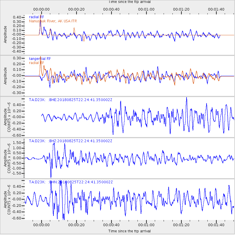
D23K Nanushuk River, AK USA - Earthquake Result Viewer
*The percent match for this event was below the threshold and hence no stack was calculated.
| Earthquake location: |
Western Iran |
| Earthquake latitude/longitude: |
34.7/46.2 |
| Earthquake time(UTC): |
2018/08/25 (237) 22:13:26 GMT |
| Earthquake Depth: |
10 km |
| Earthquake Magnitude: |
6.1 Mww |
| Earthquake Catalog/Contributor: |
NEIC PDE/us |
|
| Network: |
TA USArray Transportable Network (new EarthScope stations) |
| Station: |
D23K Nanushuk River, AK USA |
| Lat/Lon: |
68.97 N/150.68 W |
| Elevation: |
406 m |
|
| Distance: |
75.9 deg |
| Az: |
6.21 deg |
| Baz: |
345.704 deg |
| Ray Param: |
$rayparam |
*The percent match for this event was below the threshold and hence was not used in the summary stack. |
|
| Radial Match: |
69.75855 % |
| Radial Bump: |
400 |
| Transverse Match: |
64.519646 % |
| Transverse Bump: |
400 |
| SOD ConfigId: |
13570011 |
| Insert Time: |
2019-05-01 00:24:17.254 +0000 |
| GWidth: |
2.5 |
| Max Bumps: |
400 |
| Tol: |
0.001 |
|
Signal To Noise
| Channel | StoN | STA | LTA |
| TA:D23K: :BHZ:20180825T22:24:41.350002Z | 1.7994051 | 2.075325E-7 | 1.1533395E-7 |
| TA:D23K: :BHN:20180825T22:24:41.350002Z | 1.4219191 | 9.619427E-8 | 6.7651015E-8 |
| TA:D23K: :BHE:20180825T22:24:41.350002Z | 1.3650352 | 9.0236846E-8 | 6.6105876E-8 |
| Arrivals |
| Ps | |
| PpPs | |
| PsPs/PpSs | |


