You are here: Home > Network List > TA - USArray Transportable Network (new EarthScope stations) Stations List
> Station G31M Satah River, YT, CAN > Earthquake Result Viewer
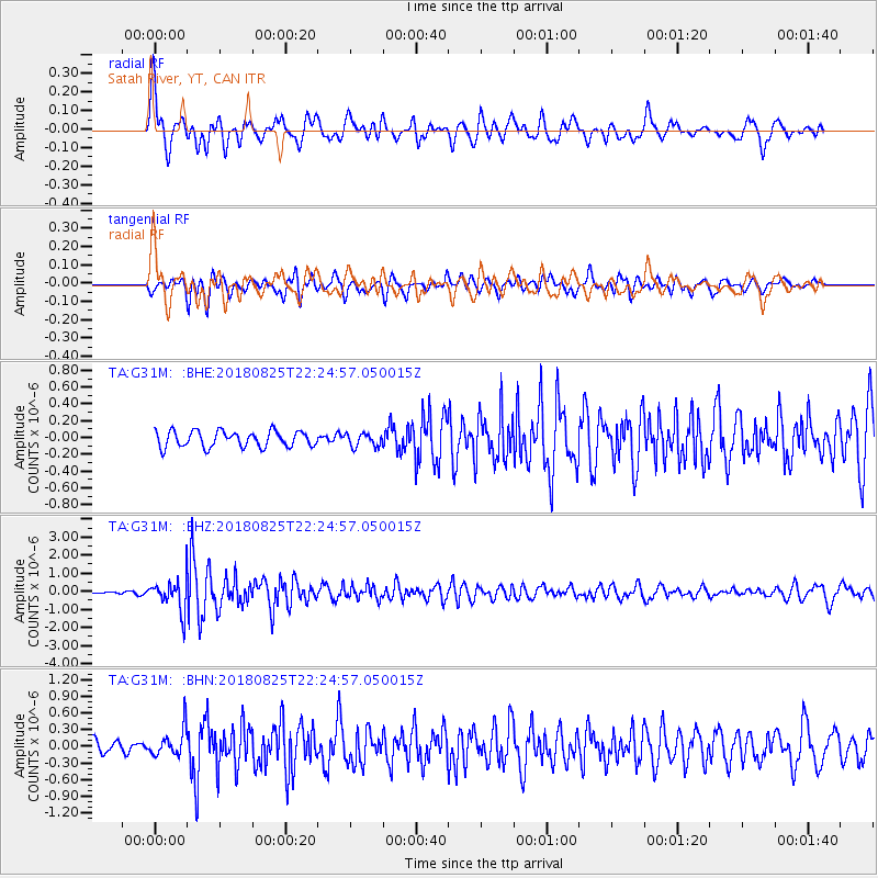
G31M Satah River, YT, CAN - Earthquake Result Viewer
*The percent match for this event was below the threshold and hence no stack was calculated.
| Earthquake location: |
Western Iran |
| Earthquake latitude/longitude: |
34.7/46.2 |
| Earthquake time(UTC): |
2018/08/25 (237) 22:13:26 GMT |
| Earthquake Depth: |
10 km |
| Earthquake Magnitude: |
6.1 Mww |
| Earthquake Catalog/Contributor: |
NEIC PDE/us |
|
| Network: |
TA USArray Transportable Network (new EarthScope stations) |
| Station: |
G31M Satah River, YT, CAN |
| Lat/Lon: |
66.92 N/134.27 W |
| Elevation: |
61 m |
|
| Distance: |
78.7 deg |
| Az: |
0.194 deg |
| Baz: |
359.594 deg |
| Ray Param: |
$rayparam |
*The percent match for this event was below the threshold and hence was not used in the summary stack. |
|
| Radial Match: |
77.72415 % |
| Radial Bump: |
400 |
| Transverse Match: |
72.85485 % |
| Transverse Bump: |
400 |
| SOD ConfigId: |
13570011 |
| Insert Time: |
2019-05-01 00:24:42.370 +0000 |
| GWidth: |
2.5 |
| Max Bumps: |
400 |
| Tol: |
0.001 |
|
Signal To Noise
| Channel | StoN | STA | LTA |
| TA:G31M: :BHZ:20180825T22:24:57.050015Z | 17.938446 | 8.664125E-7 | 4.82992E-8 |
| TA:G31M: :BHN:20180825T22:24:57.050015Z | 2.5336056 | 2.470809E-7 | 9.752145E-8 |
| TA:G31M: :BHE:20180825T22:24:57.050015Z | 0.8715224 | 8.145365E-8 | 9.346134E-8 |
| Arrivals |
| Ps | |
| PpPs | |
| PsPs/PpSs | |


