You are here: Home > Network List > TA - USArray Transportable Network (new EarthScope stations) Stations List
> Station E18K Tukpahlearik Creek, AK, USA > Earthquake Result Viewer
E18K Tukpahlearik Creek, AK, USA - Earthquake Result Viewer
*The percent match for this event was below the threshold and hence no stack was calculated.
| Earthquake location: |
Timor Region |
| Earthquake latitude/longitude: |
-10.9/124.2 |
| Earthquake time(UTC): |
2018/08/28 (240) 07:08:09 GMT |
| Earthquake Depth: |
8.6 km |
| Earthquake Magnitude: |
6.2 Mww |
| Earthquake Catalog/Contributor: |
NEIC PDE/us |
|
| Network: |
TA USArray Transportable Network (new EarthScope stations) |
| Station: |
E18K Tukpahlearik Creek, AK, USA |
| Lat/Lon: |
67.42 N/160.60 W |
| Elevation: |
297 m |
|
| Distance: |
94.4 deg |
| Az: |
21.992 deg |
| Baz: |
252.29 deg |
| Ray Param: |
$rayparam |
*The percent match for this event was below the threshold and hence was not used in the summary stack. |
|
| Radial Match: |
70.867294 % |
| Radial Bump: |
400 |
| Transverse Match: |
62.59636 % |
| Transverse Bump: |
400 |
| SOD ConfigId: |
13570011 |
| Insert Time: |
2019-05-01 00:31:33.940 +0000 |
| GWidth: |
2.5 |
| Max Bumps: |
400 |
| Tol: |
0.001 |
|
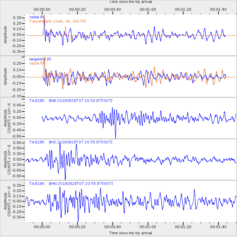
Signal To Noise
| Channel | StoN | STA | LTA |
| TA:E18K: :BHZ:20180828T07:20:58.875007Z | 3.6859138 | 2.0405734E-7 | 5.53614E-8 |
| TA:E18K: :BHN:20180828T07:20:58.875007Z | 1.6321032 | 6.224082E-8 | 3.8135347E-8 |
| TA:E18K: :BHE:20180828T07:20:58.875007Z | 1.6962011 | 9.147685E-8 | 5.3930428E-8 |
| Arrivals |
| Ps | |
| PpPs | |
| PsPs/PpSs | |


