You are here: Home > Network List > TA - USArray Transportable Network (new EarthScope stations) Stations List
> Station G23K Bananza Creek, AK, USA > Earthquake Result Viewer
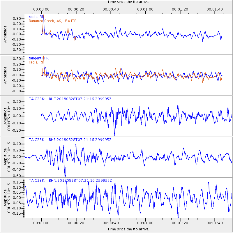
G23K Bananza Creek, AK, USA - Earthquake Result Viewer
*The percent match for this event was below the threshold and hence no stack was calculated.
| Earthquake location: |
Timor Region |
| Earthquake latitude/longitude: |
-10.9/124.2 |
| Earthquake time(UTC): |
2018/08/28 (240) 07:08:09 GMT |
| Earthquake Depth: |
8.6 km |
| Earthquake Magnitude: |
6.2 Mww |
| Earthquake Catalog/Contributor: |
NEIC PDE/us |
|
| Network: |
TA USArray Transportable Network (new EarthScope stations) |
| Station: |
G23K Bananza Creek, AK, USA |
| Lat/Lon: |
66.71 N/150.02 W |
| Elevation: |
746 m |
|
| Distance: |
98.2 deg |
| Az: |
23.621 deg |
| Baz: |
261.848 deg |
| Ray Param: |
$rayparam |
*The percent match for this event was below the threshold and hence was not used in the summary stack. |
|
| Radial Match: |
68.35901 % |
| Radial Bump: |
400 |
| Transverse Match: |
54.844765 % |
| Transverse Bump: |
400 |
| SOD ConfigId: |
13570011 |
| Insert Time: |
2019-05-01 00:31:43.458 +0000 |
| GWidth: |
2.5 |
| Max Bumps: |
400 |
| Tol: |
0.001 |
|
Signal To Noise
| Channel | StoN | STA | LTA |
| TA:G23K: :BHZ:20180828T07:21:16.299995Z | 1.6665342 | 1.0382188E-7 | 6.2298085E-8 |
| TA:G23K: :BHN:20180828T07:21:16.299995Z | 0.9997665 | 5.7950622E-8 | 5.7964154E-8 |
| TA:G23K: :BHE:20180828T07:21:16.299995Z | 1.5749267 | 6.7902086E-8 | 4.311444E-8 |
| Arrivals |
| Ps | |
| PpPs | |
| PsPs/PpSs | |


