You are here: Home > Network List > TA - USArray Transportable Network (new EarthScope stations) Stations List
> Station T17A Navajo Res., Navajo Mountain, AZ, USA > Earthquake Result Viewer
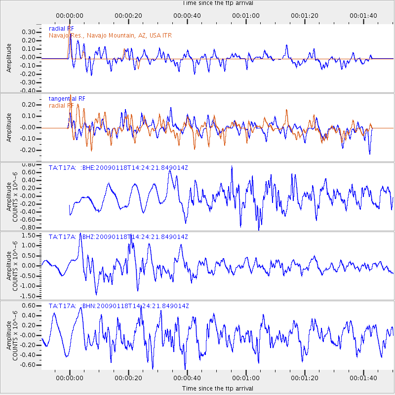
T17A Navajo Res., Navajo Mountain, AZ, USA - Earthquake Result Viewer
*The percent match for this event was below the threshold and hence no stack was calculated.
| Earthquake location: |
Kermadec Islands, New Zealand |
| Earthquake latitude/longitude: |
-30.2/-178.0 |
| Earthquake time(UTC): |
2009/01/18 (018) 14:11:48 GMT |
| Earthquake Depth: |
33 km |
| Earthquake Magnitude: |
6.0 MB, 6.1 MS, 6.4 MW, 6.4 MW |
| Earthquake Catalog/Contributor: |
WHDF/NEIC |
|
| Network: |
TA USArray Transportable Network (new EarthScope stations) |
| Station: |
T17A Navajo Res., Navajo Mountain, AZ, USA |
| Lat/Lon: |
37.00 N/110.80 W |
| Elevation: |
1876 m |
|
| Distance: |
91.8 deg |
| Az: |
47.571 deg |
| Baz: |
232.955 deg |
| Ray Param: |
$rayparam |
*The percent match for this event was below the threshold and hence was not used in the summary stack. |
|
| Radial Match: |
70.728584 % |
| Radial Bump: |
400 |
| Transverse Match: |
49.935387 % |
| Transverse Bump: |
400 |
| SOD ConfigId: |
2658 |
| Insert Time: |
2010-03-06 14:52:41.519 +0000 |
| GWidth: |
2.5 |
| Max Bumps: |
400 |
| Tol: |
0.001 |
|
Signal To Noise
| Channel | StoN | STA | LTA |
| TA:T17A: :BHZ:20090118T14:24:21.849014Z | 4.0213375 | 6.610594E-7 | 1.6438794E-7 |
| TA:T17A: :BHN:20090118T14:24:21.849014Z | 1.8616167 | 3.8467454E-7 | 2.0663465E-7 |
| TA:T17A: :BHE:20090118T14:24:21.849014Z | 1.7316508 | 3.6040512E-7 | 2.0812804E-7 |
| Arrivals |
| Ps | |
| PpPs | |
| PsPs/PpSs | |


