You are here: Home > Network List > IU - Global Seismograph Network (GSN - IRIS/USGS) Stations List
> Station PMG Port Moresby, New Guinea > Earthquake Result Viewer
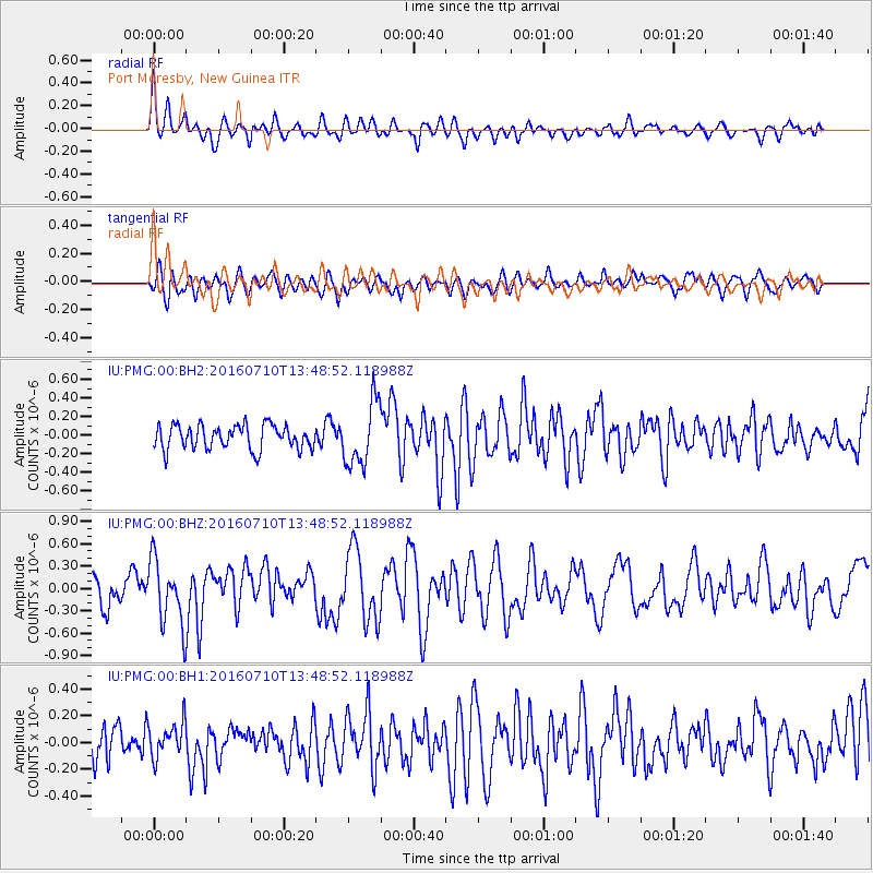
PMG Port Moresby, New Guinea - Earthquake Result Viewer
*The percent match for this event was below the threshold and hence no stack was calculated.
| Earthquake location: |
Samoa Islands Region |
| Earthquake latitude/longitude: |
-15.0/-172.9 |
| Earthquake time(UTC): |
2016/07/10 (192) 13:41:53 GMT |
| Earthquake Depth: |
10 km |
| Earthquake Magnitude: |
5.5 MB |
| Earthquake Catalog/Contributor: |
NEIC PDE/NEIC ALERT |
|
| Network: |
IU Global Seismograph Network (GSN - IRIS/USGS) |
| Station: |
PMG Port Moresby, New Guinea |
| Lat/Lon: |
9.40 S/147.16 E |
| Elevation: |
90 m |
|
| Distance: |
39.4 deg |
| Az: |
273.439 deg |
| Baz: |
102.196 deg |
| Ray Param: |
$rayparam |
*The percent match for this event was below the threshold and hence was not used in the summary stack. |
|
| Radial Match: |
60.38044 % |
| Radial Bump: |
400 |
| Transverse Match: |
61.085354 % |
| Transverse Bump: |
400 |
| SOD ConfigId: |
1634031 |
| Insert Time: |
2016-07-24 13:46:49.601 +0000 |
| GWidth: |
2.5 |
| Max Bumps: |
400 |
| Tol: |
0.001 |
|
Signal To Noise
| Channel | StoN | STA | LTA |
| IU:PMG:00:BHZ:20160710T13:48:52.118988Z | 2.6771953 | 4.3741758E-7 | 1.633865E-7 |
| IU:PMG:00:BH1:20160710T13:48:52.118988Z | 0.7940155 | 1.3299206E-7 | 1.6749303E-7 |
| IU:PMG:00:BH2:20160710T13:48:52.118988Z | 2.655076 | 3.4149411E-7 | 1.2861933E-7 |
| Arrivals |
| Ps | |
| PpPs | |
| PsPs/PpSs | |


