You are here: Home > Network List > TA - USArray Transportable Network (new EarthScope stations) Stations List
> Station D23K Nanushuk River, AK USA > Earthquake Result Viewer
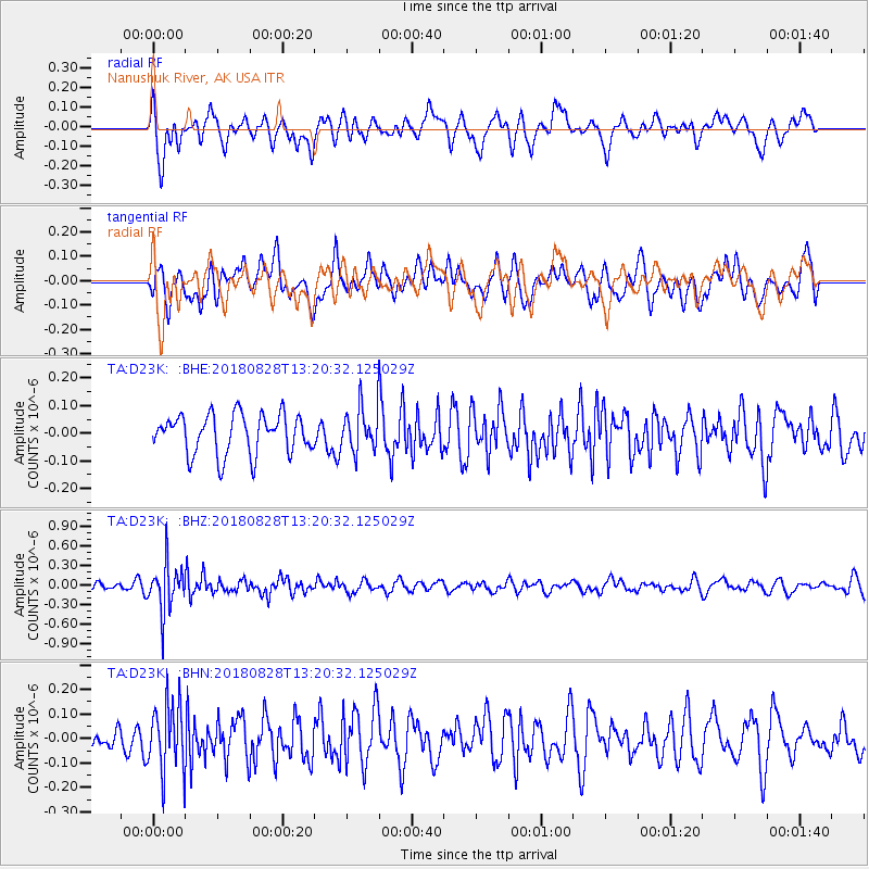
D23K Nanushuk River, AK USA - Earthquake Result Viewer
*The percent match for this event was below the threshold and hence no stack was calculated.
| Earthquake location: |
Fiji Islands Region |
| Earthquake latitude/longitude: |
-18.0/-177.9 |
| Earthquake time(UTC): |
2018/08/28 (240) 13:09:10 GMT |
| Earthquake Depth: |
592 km |
| Earthquake Magnitude: |
5.7 Mww |
| Earthquake Catalog/Contributor: |
NEIC PDE/us |
|
| Network: |
TA USArray Transportable Network (new EarthScope stations) |
| Station: |
D23K Nanushuk River, AK USA |
| Lat/Lon: |
68.97 N/150.68 W |
| Elevation: |
406 m |
|
| Distance: |
88.9 deg |
| Az: |
9.522 deg |
| Baz: |
205.846 deg |
| Ray Param: |
$rayparam |
*The percent match for this event was below the threshold and hence was not used in the summary stack. |
|
| Radial Match: |
61.81172 % |
| Radial Bump: |
400 |
| Transverse Match: |
57.402462 % |
| Transverse Bump: |
400 |
| SOD ConfigId: |
13570011 |
| Insert Time: |
2019-05-01 00:40:58.375 +0000 |
| GWidth: |
2.5 |
| Max Bumps: |
400 |
| Tol: |
0.001 |
|
Signal To Noise
| Channel | StoN | STA | LTA |
| TA:D23K: :BHZ:20180828T13:20:32.125029Z | 4.219533 | 3.721686E-7 | 8.8201375E-8 |
| TA:D23K: :BHN:20180828T13:20:32.125029Z | 3.2545447 | 1.3983511E-7 | 4.2966104E-8 |
| TA:D23K: :BHE:20180828T13:20:32.125029Z | 1.0447005 | 7.4643765E-8 | 7.1449925E-8 |
| Arrivals |
| Ps | |
| PpPs | |
| PsPs/PpSs | |


