You are here: Home > Network List > TA - USArray Transportable Network (new EarthScope stations) Stations List
> Station H16K Elim, AK, USA > Earthquake Result Viewer
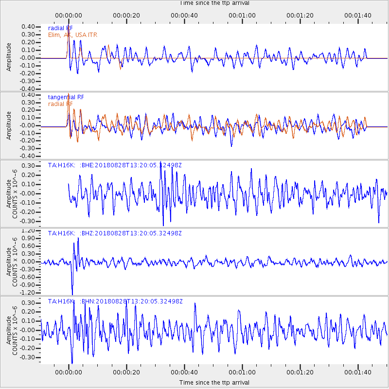
H16K Elim, AK, USA - Earthquake Result Viewer
*The percent match for this event was below the threshold and hence no stack was calculated.
| Earthquake location: |
Fiji Islands Region |
| Earthquake latitude/longitude: |
-18.0/-177.9 |
| Earthquake time(UTC): |
2018/08/28 (240) 13:09:10 GMT |
| Earthquake Depth: |
592 km |
| Earthquake Magnitude: |
5.7 Mww |
| Earthquake Catalog/Contributor: |
NEIC PDE/us |
|
| Network: |
TA USArray Transportable Network (new EarthScope stations) |
| Station: |
H16K Elim, AK, USA |
| Lat/Lon: |
64.64 N/162.24 W |
| Elevation: |
216 m |
|
| Distance: |
83.3 deg |
| Az: |
6.742 deg |
| Baz: |
195.032 deg |
| Ray Param: |
$rayparam |
*The percent match for this event was below the threshold and hence was not used in the summary stack. |
|
| Radial Match: |
53.62537 % |
| Radial Bump: |
400 |
| Transverse Match: |
62.43638 % |
| Transverse Bump: |
396 |
| SOD ConfigId: |
13570011 |
| Insert Time: |
2019-05-01 00:41:28.238 +0000 |
| GWidth: |
2.5 |
| Max Bumps: |
400 |
| Tol: |
0.001 |
|
Signal To Noise
| Channel | StoN | STA | LTA |
| TA:H16K: :BHZ:20180828T13:20:05.32498Z | 5.2409883 | 4.2082843E-7 | 8.029562E-8 |
| TA:H16K: :BHN:20180828T13:20:05.32498Z | 1.3570334 | 1.3996141E-7 | 1.03137786E-7 |
| TA:H16K: :BHE:20180828T13:20:05.32498Z | 1.6119689 | 1.5045576E-7 | 9.3336645E-8 |
| Arrivals |
| Ps | |
| PpPs | |
| PsPs/PpSs | |


