You are here: Home > Network List > TA - USArray Transportable Network (new EarthScope stations) Stations List
> Station I17K Unalakleet, AK, USA > Earthquake Result Viewer
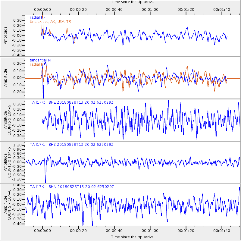
I17K Unalakleet, AK, USA - Earthquake Result Viewer
*The percent match for this event was below the threshold and hence no stack was calculated.
| Earthquake location: |
Fiji Islands Region |
| Earthquake latitude/longitude: |
-18.0/-177.9 |
| Earthquake time(UTC): |
2018/08/28 (240) 13:09:10 GMT |
| Earthquake Depth: |
592 km |
| Earthquake Magnitude: |
5.7 Mww |
| Earthquake Catalog/Contributor: |
NEIC PDE/us |
|
| Network: |
TA USArray Transportable Network (new EarthScope stations) |
| Station: |
I17K Unalakleet, AK, USA |
| Lat/Lon: |
63.89 N/160.70 W |
| Elevation: |
105 m |
|
| Distance: |
82.7 deg |
| Az: |
7.602 deg |
| Baz: |
196.526 deg |
| Ray Param: |
$rayparam |
*The percent match for this event was below the threshold and hence was not used in the summary stack. |
|
| Radial Match: |
45.13559 % |
| Radial Bump: |
400 |
| Transverse Match: |
57.76035 % |
| Transverse Bump: |
400 |
| SOD ConfigId: |
13570011 |
| Insert Time: |
2019-05-01 00:41:36.207 +0000 |
| GWidth: |
2.5 |
| Max Bumps: |
400 |
| Tol: |
0.001 |
|
Signal To Noise
| Channel | StoN | STA | LTA |
| TA:I17K: :BHZ:20180828T13:20:02.625029Z | 3.1280534 | 4.4437448E-7 | 1.4206103E-7 |
| TA:I17K: :BHN:20180828T13:20:02.625029Z | 1.2410749 | 1.3091092E-7 | 1.0548189E-7 |
| TA:I17K: :BHE:20180828T13:20:02.625029Z | 0.95805657 | 1.2686291E-7 | 1.3241693E-7 |
| Arrivals |
| Ps | |
| PpPs | |
| PsPs/PpSs | |


