You are here: Home > Network List > UW - Pacific Northwest Regional Seismic Network Stations List
> Station UMAT Pilot Rock, OR, USA > Earthquake Result Viewer
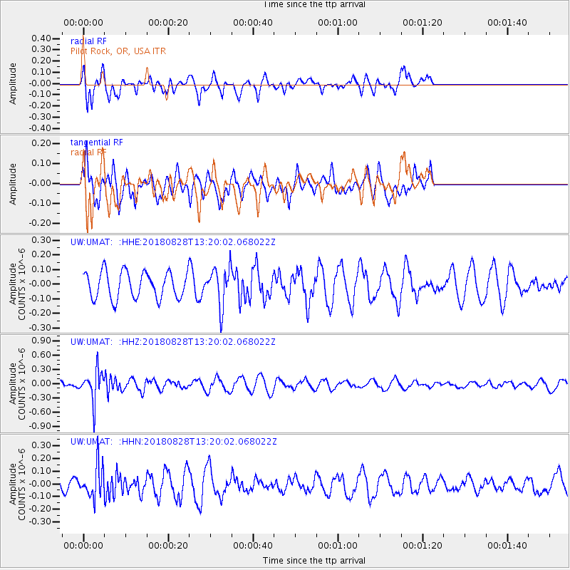
UMAT Pilot Rock, OR, USA - Earthquake Result Viewer
*The percent match for this event was below the threshold and hence no stack was calculated.
| Earthquake location: |
Fiji Islands Region |
| Earthquake latitude/longitude: |
-18.0/-177.9 |
| Earthquake time(UTC): |
2018/08/28 (240) 13:09:10 GMT |
| Earthquake Depth: |
592 km |
| Earthquake Magnitude: |
5.7 Mww |
| Earthquake Catalog/Contributor: |
NEIC PDE/us |
|
| Network: |
UW Pacific Northwest Regional Seismic Network |
| Station: |
UMAT Pilot Rock, OR, USA |
| Lat/Lon: |
45.29 N/118.96 W |
| Elevation: |
1318 m |
|
| Distance: |
82.6 deg |
| Az: |
37.59 deg |
| Baz: |
235.31 deg |
| Ray Param: |
$rayparam |
*The percent match for this event was below the threshold and hence was not used in the summary stack. |
|
| Radial Match: |
66.44044 % |
| Radial Bump: |
310 |
| Transverse Match: |
63.117756 % |
| Transverse Bump: |
400 |
| SOD ConfigId: |
13570011 |
| Insert Time: |
2019-05-01 00:43:42.217 +0000 |
| GWidth: |
2.5 |
| Max Bumps: |
400 |
| Tol: |
0.001 |
|
Signal To Noise
| Channel | StoN | STA | LTA |
| UW:UMAT: :HHZ:20180828T13:20:02.068022Z | 5.5583544 | 3.1757983E-7 | 5.7135583E-8 |
| UW:UMAT: :HHN:20180828T13:20:02.068022Z | 2.0901706 | 1.304645E-7 | 6.24181E-8 |
| UW:UMAT: :HHE:20180828T13:20:02.068022Z | 1.4291596 | 1.2942286E-7 | 9.0558714E-8 |
| Arrivals |
| Ps | |
| PpPs | |
| PsPs/PpSs | |


