You are here: Home > Network List > TA - USArray Transportable Network (new EarthScope stations) Stations List
> Station S18A Hurst Farm, Blanding, UT, USA > Earthquake Result Viewer
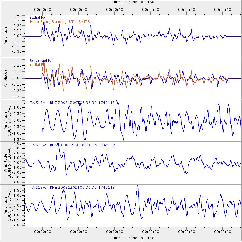
S18A Hurst Farm, Blanding, UT, USA - Earthquake Result Viewer
*The percent match for this event was below the threshold and hence no stack was calculated.
| Earthquake location: |
Kermadec Islands Region |
| Earthquake latitude/longitude: |
-31.2/-176.9 |
| Earthquake time(UTC): |
2008/12/09 (344) 06:23:59 GMT |
| Earthquake Depth: |
18 km |
| Earthquake Magnitude: |
6.2 MB, 6.7 MS, 6.8 MW, 6.7 MW |
| Earthquake Catalog/Contributor: |
WHDF/NEIC |
|
| Network: |
TA USArray Transportable Network (new EarthScope stations) |
| Station: |
S18A Hurst Farm, Blanding, UT, USA |
| Lat/Lon: |
37.69 N/109.99 W |
| Elevation: |
2351 m |
|
| Distance: |
92.7 deg |
| Az: |
46.945 deg |
| Baz: |
232.093 deg |
| Ray Param: |
$rayparam |
*The percent match for this event was below the threshold and hence was not used in the summary stack. |
|
| Radial Match: |
59.239277 % |
| Radial Bump: |
400 |
| Transverse Match: |
53.82945 % |
| Transverse Bump: |
400 |
| SOD ConfigId: |
2658 |
| Insert Time: |
2010-03-06 14:56:11.032 +0000 |
| GWidth: |
2.5 |
| Max Bumps: |
400 |
| Tol: |
0.001 |
|
Signal To Noise
| Channel | StoN | STA | LTA |
| TA:S18A: :BHN:20081209T06:36:39.174011Z | 2.614114 | 8.7959353E-7 | 3.3647865E-7 |
| TA:S18A: :BHE:20081209T06:36:39.174011Z | 1.0212303 | 3.9580047E-7 | 3.8757216E-7 |
| TA:S18A: :BHZ:20081209T06:36:39.174011Z | 0.416546 | 3.2066356E-7 | 7.6981553E-7 |
| Arrivals |
| Ps | |
| PpPs | |
| PsPs/PpSs | |


