You are here: Home > Network List > TA - USArray Transportable Network (new EarthScope stations) Stations List
> Station R16A Teasdale, UT, USA > Earthquake Result Viewer
R16A Teasdale, UT, USA - Earthquake Result Viewer

| Earthquake location: |
Andreanof Islands, Aleutian Is. |
| Earthquake latitude/longitude: |
52.2/-178.7 |
| Earthquake time(UTC): |
2008/03/22 (082) 21:24:11 GMT |
| Earthquake Depth: |
132 km |
| Earthquake Magnitude: |
5.8 MB, 6.2 MW, 6.1 MW |
| Earthquake Catalog/Contributor: |
WHDF/NEIC |
|
| Network: |
TA USArray Transportable Network (new EarthScope stations) |
| Station: |
R16A Teasdale, UT, USA |
| Lat/Lon: |
38.28 N/111.48 W |
| Elevation: |
2202 m |
|
| Distance: |
47.6 deg |
| Az: |
79.08 deg |
| Baz: |
309.795 deg |
| Ray Param: |
0.06940926 |
| Estimated Moho Depth: |
11.5 km |
| Estimated Crust Vp/Vs: |
2.10 |
| Assumed Crust Vp: |
6.207 km/s |
| Estimated Crust Vs: |
2.959 km/s |
| Estimated Crust Poisson's Ratio: |
0.35 |
|
| Radial Match: |
91.07165 % |
| Radial Bump: |
400 |
| Transverse Match: |
85.14986 % |
| Transverse Bump: |
400 |
| SOD ConfigId: |
2564 |
| Insert Time: |
2010-03-06 14:57:14.424 +0000 |
| GWidth: |
2.5 |
| Max Bumps: |
400 |
| Tol: |
0.001 |
|
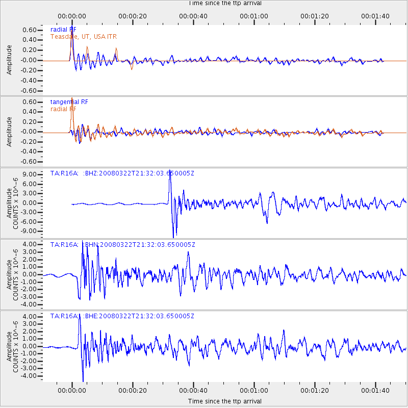
Signal To Noise
| Channel | StoN | STA | LTA |
| TA:R16A: :BHN:20080322T21:32:03.650005Z | 16.909924 | 1.602513E-6 | 9.476761E-8 |
| TA:R16A: :BHE:20080322T21:32:03.650005Z | 18.55515 | 1.8046029E-6 | 9.7256176E-8 |
| TA:R16A: :BHZ:20080322T21:32:03.650005Z | 28.190884 | 4.7176736E-6 | 1.6734748E-7 |
| Arrivals |
| Ps | 2.1 SECOND |
| PpPs | 5.5 SECOND |
| PsPs/PpSs | 7.6 SECOND |


