You are here: Home > Network List > TA - USArray Transportable Network (new EarthScope stations) Stations List
> Station I23K Minto, Yukon-Koyukuk, AK, USA > Earthquake Result Viewer
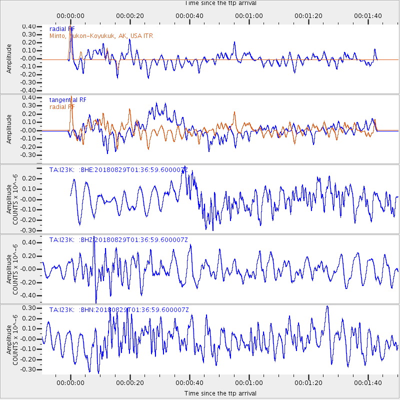
I23K Minto, Yukon-Koyukuk, AK, USA - Earthquake Result Viewer
*The percent match for this event was below the threshold and hence no stack was calculated.
| Earthquake location: |
Fiji Islands |
| Earthquake latitude/longitude: |
-16.4/178.0 |
| Earthquake time(UTC): |
2018/08/29 (241) 01:24:55 GMT |
| Earthquake Depth: |
10 km |
| Earthquake Magnitude: |
5.7 mb |
| Earthquake Catalog/Contributor: |
NEIC PDE/us |
|
| Network: |
TA USArray Transportable Network (new EarthScope stations) |
| Station: |
I23K Minto, Yukon-Koyukuk, AK, USA |
| Lat/Lon: |
65.15 N/149.36 W |
| Elevation: |
149 m |
|
| Distance: |
85.0 deg |
| Az: |
13.216 deg |
| Baz: |
211.284 deg |
| Ray Param: |
$rayparam |
*The percent match for this event was below the threshold and hence was not used in the summary stack. |
|
| Radial Match: |
59.851288 % |
| Radial Bump: |
400 |
| Transverse Match: |
40.43356 % |
| Transverse Bump: |
400 |
| SOD ConfigId: |
13570011 |
| Insert Time: |
2019-05-01 01:04:44.747 +0000 |
| GWidth: |
2.5 |
| Max Bumps: |
400 |
| Tol: |
0.001 |
|
Signal To Noise
| Channel | StoN | STA | LTA |
| TA:I23K: :BHZ:20180829T01:36:59.600007Z | 1.5732399 | 1.2523469E-7 | 7.960305E-8 |
| TA:I23K: :BHN:20180829T01:36:59.600007Z | 1.7944176 | 1.2513433E-7 | 6.973534E-8 |
| TA:I23K: :BHE:20180829T01:36:59.600007Z | 0.9990852 | 9.6021616E-8 | 9.6109545E-8 |
| Arrivals |
| Ps | |
| PpPs | |
| PsPs/PpSs | |


