You are here: Home > Network List > TA - USArray Transportable Network (new EarthScope stations) Stations List
> Station R16A Teasdale, UT, USA > Earthquake Result Viewer
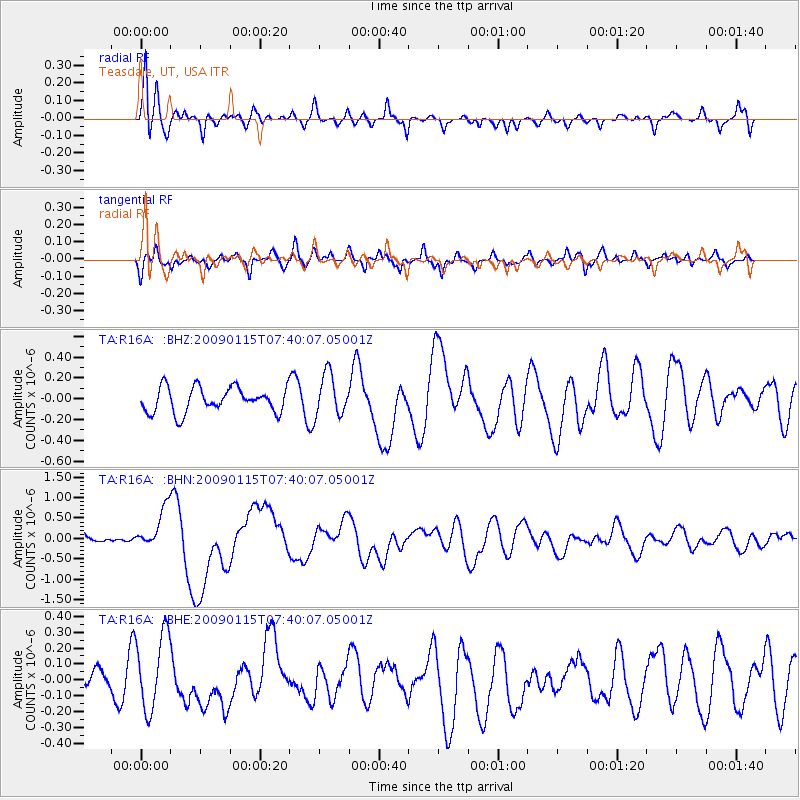
R16A Teasdale, UT, USA - Earthquake Result Viewer
*The percent match for this event was below the threshold and hence no stack was calculated.
| Earthquake location: |
Southeast Of Loyalty Islands |
| Earthquake latitude/longitude: |
-22.4/170.6 |
| Earthquake time(UTC): |
2009/01/15 (015) 07:27:20 GMT |
| Earthquake Depth: |
27 km |
| Earthquake Magnitude: |
5.8 MB, 6.5 MS, 6.7 MW, 6.6 MW |
| Earthquake Catalog/Contributor: |
WHDF/NEIC |
|
| Network: |
TA USArray Transportable Network (new EarthScope stations) |
| Station: |
R16A Teasdale, UT, USA |
| Lat/Lon: |
38.28 N/111.48 W |
| Elevation: |
2202 m |
|
| Distance: |
94.6 deg |
| Az: |
50.527 deg |
| Baz: |
245.24 deg |
| Ray Param: |
$rayparam |
*The percent match for this event was below the threshold and hence was not used in the summary stack. |
|
| Radial Match: |
66.84267 % |
| Radial Bump: |
400 |
| Transverse Match: |
44.035164 % |
| Transverse Bump: |
400 |
| SOD ConfigId: |
2834 |
| Insert Time: |
2010-03-06 14:58:41.575 +0000 |
| GWidth: |
2.5 |
| Max Bumps: |
400 |
| Tol: |
0.001 |
|
Signal To Noise
| Channel | StoN | STA | LTA |
| TA:R16A: :BHN:20090115T07:40:07.05001Z | 2.9745677 | 5.100554E-7 | 1.7147211E-7 |
| TA:R16A: :BHE:20090115T07:40:07.05001Z | 1.9035916 | 2.4296307E-7 | 1.2763404E-7 |
| TA:R16A: :BHZ:20090115T07:40:07.05001Z | 1.688619 | 2.0066506E-7 | 1.18833825E-7 |
| Arrivals |
| Ps | |
| PpPs | |
| PsPs/PpSs | |


