You are here: Home > Network List > TA - USArray Transportable Network (new EarthScope stations) Stations List
> Station R16A Teasdale, UT, USA > Earthquake Result Viewer
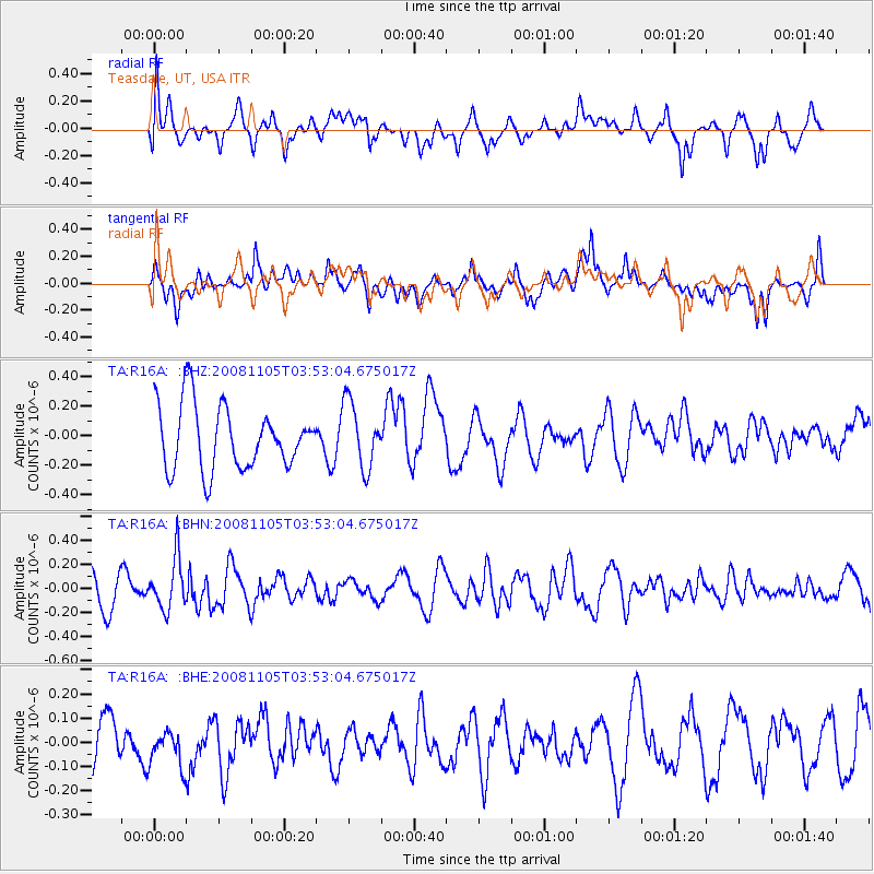
R16A Teasdale, UT, USA - Earthquake Result Viewer
*The percent match for this event was below the threshold and hence no stack was calculated.
| Earthquake location: |
Tonga Islands |
| Earthquake latitude/longitude: |
-17.3/-174.4 |
| Earthquake time(UTC): |
2008/11/05 (310) 03:41:43 GMT |
| Earthquake Depth: |
188 km |
| Earthquake Magnitude: |
5.7 MW, 5.1 MB, 5.7 MW |
| Earthquake Catalog/Contributor: |
WHDF/NEIC |
|
| Network: |
TA USArray Transportable Network (new EarthScope stations) |
| Station: |
R16A Teasdale, UT, USA |
| Lat/Lon: |
38.28 N/111.48 W |
| Elevation: |
2202 m |
|
| Distance: |
80.8 deg |
| Az: |
45.202 deg |
| Baz: |
239.463 deg |
| Ray Param: |
$rayparam |
*The percent match for this event was below the threshold and hence was not used in the summary stack. |
|
| Radial Match: |
39.363983 % |
| Radial Bump: |
400 |
| Transverse Match: |
65.54996 % |
| Transverse Bump: |
400 |
| SOD ConfigId: |
2658 |
| Insert Time: |
2010-03-06 14:59:15.867 +0000 |
| GWidth: |
2.5 |
| Max Bumps: |
400 |
| Tol: |
0.001 |
|
Signal To Noise
| Channel | StoN | STA | LTA |
| TA:R16A: :BHN:20081105T03:53:04.675017Z | 2.1462276 | 2.1313053E-7 | 9.930473E-8 |
| TA:R16A: :BHE:20081105T03:53:04.675017Z | 0.75263613 | 7.8259305E-8 | 1.0398027E-7 |
| TA:R16A: :BHZ:20081105T03:53:04.675017Z | 1.0289583 | 2.2139338E-7 | 2.1516264E-7 |
| Arrivals |
| Ps | |
| PpPs | |
| PsPs/PpSs | |


