You are here: Home > Network List > UW - Pacific Northwest Regional Seismic Network Stations List
> Station YACT Amboy, WA, USA > Earthquake Result Viewer
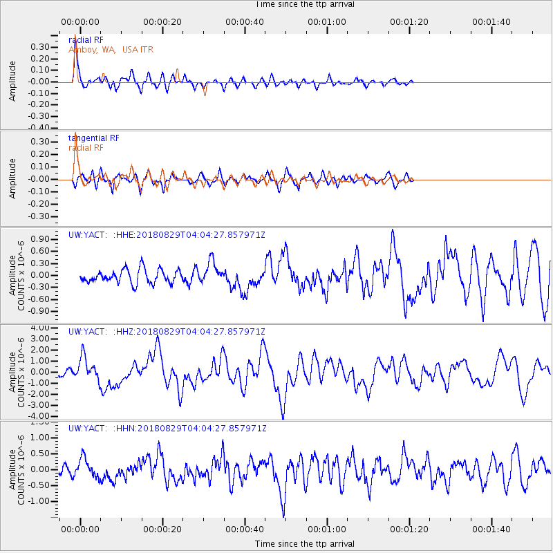
YACT Amboy, WA, USA - Earthquake Result Viewer
*The percent match for this event was below the threshold and hence no stack was calculated.
| Earthquake location: |
Southeast Of Loyalty Islands |
| Earthquake latitude/longitude: |
-22.2/170.0 |
| Earthquake time(UTC): |
2018/08/29 (241) 03:51:55 GMT |
| Earthquake Depth: |
10 km |
| Earthquake Magnitude: |
7.0 Mi |
| Earthquake Catalog/Contributor: |
NEIC PDE/pt |
|
| Network: |
UW Pacific Northwest Regional Seismic Network |
| Station: |
YACT Amboy, WA, USA |
| Lat/Lon: |
45.93 N/122.42 W |
| Elevation: |
211 m |
|
| Distance: |
91.3 deg |
| Az: |
40.198 deg |
| Baz: |
238.996 deg |
| Ray Param: |
$rayparam |
*The percent match for this event was below the threshold and hence was not used in the summary stack. |
|
| Radial Match: |
79.425705 % |
| Radial Bump: |
400 |
| Transverse Match: |
75.60596 % |
| Transverse Bump: |
400 |
| SOD ConfigId: |
13570011 |
| Insert Time: |
2019-05-01 01:16:50.932 +0000 |
| GWidth: |
2.5 |
| Max Bumps: |
400 |
| Tol: |
0.001 |
|
Signal To Noise
| Channel | StoN | STA | LTA |
| UW:YACT: :HHZ:20180829T04:04:27.857971Z | 4.3788586 | 1.1254041E-6 | 2.5700857E-7 |
| UW:YACT: :HHN:20180829T04:04:27.857971Z | 1.8404177 | 3.1292296E-7 | 1.7002822E-7 |
| UW:YACT: :HHE:20180829T04:04:27.857971Z | 1.6801095 | 2.8246689E-7 | 1.6812409E-7 |
| Arrivals |
| Ps | |
| PpPs | |
| PsPs/PpSs | |


