L14A Malta, ID, USA - Earthquake Result Viewer
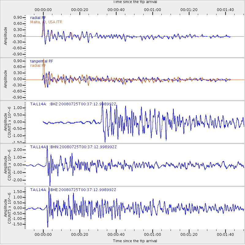
Earthquake location: Rat Islands, Aleutian Islands
Earthquake latitude/longitude: 51.3/179.0
Earthquake time(UTC): 2008/07/25 (207) 00:29:22 GMT
Earthquake Depth: 21 km
Earthquake Magnitude: 5.7 MB, 5.5 MS, 5.9 MW, 5.9 MW
Earthquake Catalog/Contributor: WHDF/NEIC
Network: TA USArray Transportable Network (new EarthScope stations)
Station: L14A Malta, ID, USA
Lat/Lon: 42.03 N/113.24 W
Elevation: 1528 m
Distance: 45.9 deg
Az: 73.847 deg
Baz: 305.923 deg
Ray Param: 0.070956364
Estimated Moho Depth: 36.25 km
Estimated Crust Vp/Vs: 1.79
Assumed Crust Vp: 6.279 km/s
Estimated Crust Vs: 3.503 km/s
Estimated Crust Poisson's Ratio: 0.27
Radial Match: 89.28685 %
Radial Bump: 400
Transverse Match: 78.81291 %
Transverse Bump: 400
SOD ConfigId: 2504
Insert Time: 2010-03-06 15:01:46.681 +0000
GWidth: 2.5
Max Bumps: 400
Tol: 0.001

Signal To Noise

ChannelStoNSTALTA
TA:L14A: :BHN:20080725T00:37:12.998992Z26.8408971.0491599E-63.9088107E-8
TA:L14A: :BHE:20080725T00:37:12.998992Z10.8454456.946504E-76.4049964E-8
TA:L14A: :BHZ:20080725T00:37:12.998992Z14.68557556.3350706E-74.3138048E-8
Arrivals
Ps4.9 SECOND
PpPs15 SECOND
PsPs/PpSs20 SECOND