You are here: Home > Network List > AV - Alaska Volcano Observatory Stations List
> Station AMKA Regional Station, Amchitka Island, Alaska > Earthquake Result Viewer
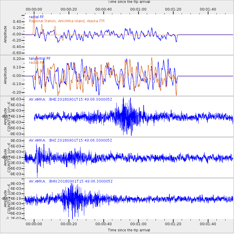
AMKA Regional Station, Amchitka Island, Alaska - Earthquake Result Viewer
*The percent match for this event was below the threshold and hence no stack was calculated.
| Earthquake location: |
Bonin Islands, Japan Region |
| Earthquake latitude/longitude: |
27.9/139.9 |
| Earthquake time(UTC): |
2018/09/01 (244) 15:43:02 GMT |
| Earthquake Depth: |
455 km |
| Earthquake Magnitude: |
5.6 Mww |
| Earthquake Catalog/Contributor: |
NEIC PDE/us |
|
| Network: |
AV Alaska Volcano Observatory |
| Station: |
AMKA Regional Station, Amchitka Island, Alaska |
| Lat/Lon: |
51.38 N/179.30 E |
| Elevation: |
116 m |
|
| Distance: |
37.6 deg |
| Az: |
40.597 deg |
| Baz: |
246.744 deg |
| Ray Param: |
$rayparam |
*The percent match for this event was below the threshold and hence was not used in the summary stack. |
|
| Radial Match: |
47.922123 % |
| Radial Bump: |
400 |
| Transverse Match: |
54.8226 % |
| Transverse Bump: |
400 |
| SOD ConfigId: |
13570011 |
| Insert Time: |
2019-05-01 01:33:55.394 +0000 |
| GWidth: |
2.5 |
| Max Bumps: |
400 |
| Tol: |
0.001 |
|
Signal To Noise
| Channel | StoN | STA | LTA |
| AV:AMKA: :BHZ:20180901T15:49:06.300005Z | 3.2445946 | 3.2510654E-9 | 1.0019944E-9 |
| AV:AMKA: :BHN:20180901T15:49:06.300005Z | 1.5120878 | 1.3442688E-9 | 8.89015E-10 |
| AV:AMKA: :BHE:20180901T15:49:06.300005Z | 1.519089 | 1.4695505E-9 | 9.673894E-10 |
| Arrivals |
| Ps | |
| PpPs | |
| PsPs/PpSs | |


